1914 C.F. Weber / Punnett Map of Mendocino County, California
MendocinoCounty-punnett-1914$600.00

Title
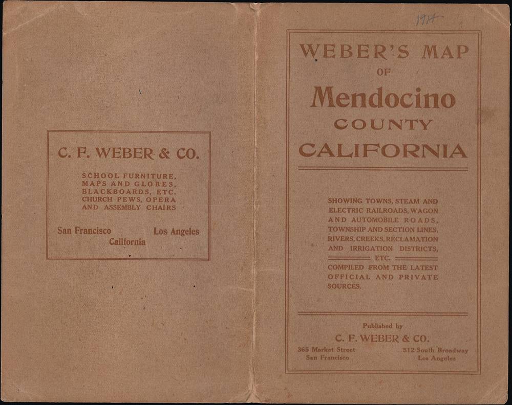
Weber's Map of Mendocino County California.
1914 (dated) 35 x 26.5 in (88.9 x 67.31 cm) 1 : 165000
1914 (dated) 35 x 26.5 in (88.9 x 67.31 cm) 1 : 165000
Description
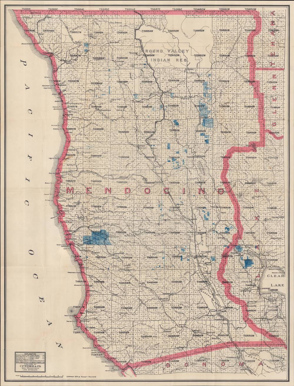
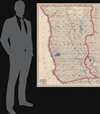
This is a 1914 map of Mendocino County, California, produced by C.F. Weber and Co. and the Punnett Brothers. It depicts the county as its population was rapidly increasing in tandem with the local lumber industry.
In addition to the Northwestern Pacific Railroad (discussed below), the California Western Railroad (popularly known as the 'skunk train') at center-left stretches from Willets to Fort Bragg. It was originally built for transporting logs but is still partially in operation as a tourist train. Several small railroads stretch from coastal settlements into the interior forests, presumably also for logging purposes.
As white settlers arrived in increasing numbers in the late 19th century, a town emerged at Ukiah (at center, towards bottom-right, still the county seat and largest city with some 16,600 residents). Ukiah remained isolated until it was linked to the Bay Area to the south in 1889 by a railroad, built through the two ranchos along the Russian River, later known as the Northwestern Pacific Railroad.
Mendocino County's population grew in the early 20th century in tandem with a lumber boom and the area saw steady population growth in the postwar period, as in California as a whole, though in terms of population it remains much smaller than nearby coastal counties (Marin, Sonoma, Humboldt). Along with Humboldt County, the coastal portion of Mendocino County is colloquially known as the 'Lost Coast,' an area of incredible natural beauty that is often forgotten, even by residents of the populous Bay Area just to the south. Mendocino County shares similarities with its more famous neighboring counties, such as vineyards, forests of redwood trees, and extensive cannabis production.
A Closer Look
The map covers the entirety of Mendocino County along with portions of neighboring counties (Sonoma, Lake, Glenn, Tehama, though not Trinity and Humboldt to the north). The county is divided into blocks subdivided into 6 x 6 grids, perhaps the 'township and section lines' referred to on the cover, with some exceptions such as the Sanel and Yokaya Ranchos and the Round Valley Indian Reservation. The meaning of the blue shaded squares and annotations is uncertain, but most likely they refer to drainage and irrigation districts (the makers of this map had collaborated on an irrigation map of Mendocino County in 1909).In addition to the Northwestern Pacific Railroad (discussed below), the California Western Railroad (popularly known as the 'skunk train') at center-left stretches from Willets to Fort Bragg. It was originally built for transporting logs but is still partially in operation as a tourist train. Several small railroads stretch from coastal settlements into the interior forests, presumably also for logging purposes.
Mendocino County
As with northern California in general, the impact of Spanish and Mexican colonization was minimal in Mendocino County, limited to the Ranchos of Sanel and Yokaya, granted in the 1840s to Mexican rancheros. Interaction between indigenous peoples and outsiders increased with the arrival of white settlers from the eastern United States in the 1850s. Soon afterwards, a violent history of atrocities, enslavement, and genocide against Native Americans ensued, most notably in the 'Mendocino War' (really a series of massacres) in 1859. One of the main promoters and financiers of the militias who carried out this violence was a local rancher and lawyer named Serranus Clinton Hastings, later a Chief Justice of the California Supreme Court, the state's Attorney General, and the founder of the Hastings College of the Law.As white settlers arrived in increasing numbers in the late 19th century, a town emerged at Ukiah (at center, towards bottom-right, still the county seat and largest city with some 16,600 residents). Ukiah remained isolated until it was linked to the Bay Area to the south in 1889 by a railroad, built through the two ranchos along the Russian River, later known as the Northwestern Pacific Railroad.
Mendocino County's population grew in the early 20th century in tandem with a lumber boom and the area saw steady population growth in the postwar period, as in California as a whole, though in terms of population it remains much smaller than nearby coastal counties (Marin, Sonoma, Humboldt). Along with Humboldt County, the coastal portion of Mendocino County is colloquially known as the 'Lost Coast,' an area of incredible natural beauty that is often forgotten, even by residents of the populous Bay Area just to the south. Mendocino County shares similarities with its more famous neighboring counties, such as vineyards, forests of redwood trees, and extensive cannabis production.
Publication History and Census
This map is part of an untitled collection of land surveys of California counties (OCLC 60459736) published in 1914 by C.F. Weber and Co. and Punnett Brothers. Though not explicitly stated, it appears that the map was drafted by the Punnett Brothers and published by Weber and Co. The two companies collaborated on a map of Mendocino County produced five years prior in 1909 that focused on irrigation, but it is unclear if that was an earlier edition of this map. This edition is only known to be held by Stanford University as part of the aforementioned collection of land surveys and has no known history on the market.CartographerS
Punnett Brothers (fl. c. 1890 - 1920) were San Francisco-based cartographers and publishers that produced a range of maps relating to the San Francisco Bay Area and California, as well as some of other parts of the world. More by this mapmaker...
C.F. Weber and Co. (fl. c. 1899 - 1914) was a California (San Francisco and Los Angeles) based producer of maps and globes, along with other goods designed for use in classrooms and churches. They were especially known for producing a series of maps of California's counties. Learn More...
Condition
Very good. Original fold lines visible with minimal wear.