1597 Wytfliet Map of Mexico
Mexico-wytfliet-1597$1,000.00

Title
Hispania Nova.
1597 (undated) 9 x 11.25 in (22.86 x 28.575 cm) 1 : 9700000
1597 (undated) 9 x 11.25 in (22.86 x 28.575 cm) 1 : 9700000
Description
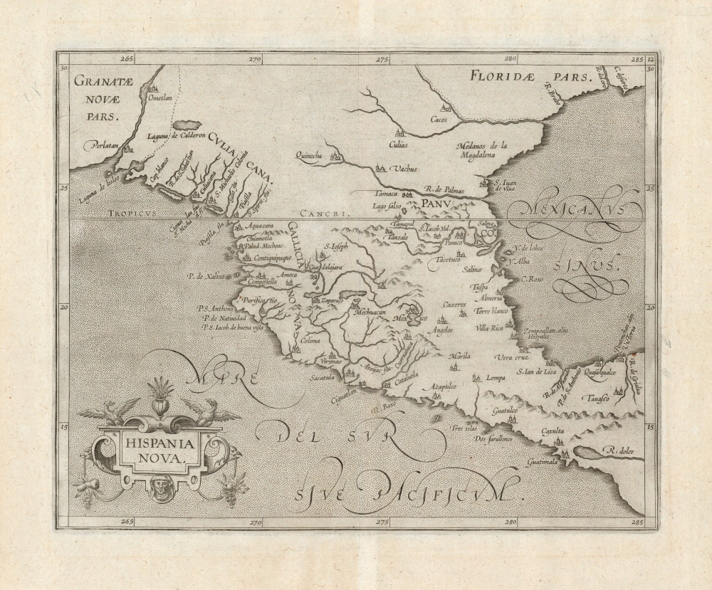
This is Cornelis Wytfliet's 1597 map of Mexico, one of the first maps of the region overall and the first to appear in an atlas dedicated to the Americas.
A Closer Look
The map depicts Mexico - or rather the portion termed Hispania Nova - spanning from modern-day Sinaloa (Culiacan is marked and named) to the vicinity of Guatemala ('Guatimala'). Acapulco and Tabasco are marked, though the Yucatan is too far east to appear on the map. Among the many cities named are Guadalajara, Veracruz, and Mexico. The Rio Grande is here named R. de Palmas, one of its names prior to Oñate's renaming of the river in 1598. Wytfliet's source - as with many of the maps of his atlas - was the 1592 Plancius Nova et Exacta Terrarum Orbis Tabula Geographica Ac Hydrographica.Publication History and Census
The map was engraved in Louvain for inclusion in Cornelis Wytfliet's Descriptionis Ptolemaicae Augmentum and appeared without change in all editions of that work. The separate map is cataloged in nine institutional collections. It appears on the market from time to time.Cartographer
Cornelius van Wytfliet (1555 - 1597) was a Flemish cartographer and engraver active in the second half of the 16th century. Little unfortunately is known of Wytfliet's life or education. He seems to have been employed as secretary to the Council of Brabant, essentially the supreme court of the Duchy of Brabant. In cartographic circles Wytfliet is best known for his publication in 1597 of Descriptionis Ptolemaicae Augmentum, the first atlas dedicated exclusively to the America's. Wytfliet imaged the atlas as a supplement to classical Ptolemaic geographic, which traditionally accounted only for Europe, Africa, and Asia. The 19 maps contained within the Descriptionis Ptolemaicae Augmentum are some of the earliest specific maps detailed various parts of the Americas. More by this mapmaker...
Source
Wytfliet, C., Descriptionis Ptolemaicae Augmentum, (Louvain: Bogardus) 1597.
Condition
Very good.
References
OCLC 13016035. Rumsey 11622.045. Burden, P., The Mapping of North America, 105.