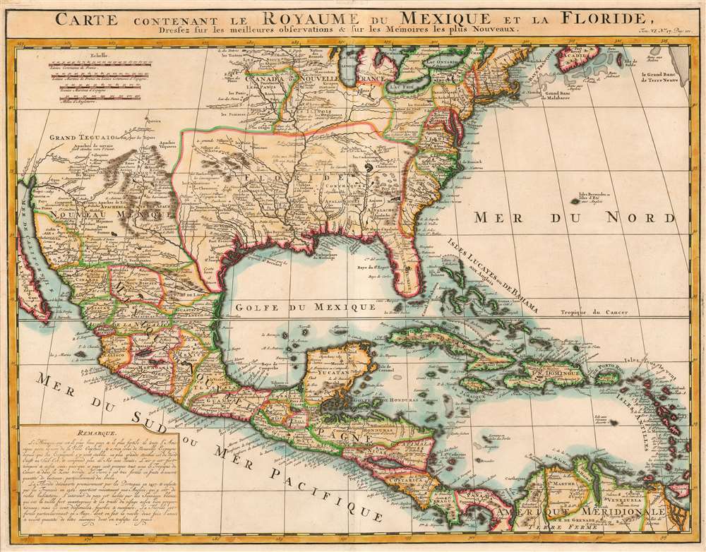
1719 Chatelain Map of Mexico and Colonial North America
MexicoFlorida-chatelain-1719$950.00

Title
Carte Contenant le Royaume du Mexique et la Floride.
1719 (undated) 16 x 20.75 in (40.64 x 52.705 cm) 1 : 11500000
1719 (undated) 16 x 20.75 in (40.64 x 52.705 cm) 1 : 11500000
Description
A charming 1719 Chatelain map of North America, Mexico, Central America, and the Caribbean.
A Closer Look
Though the map's geography relied heavily on De l'Isle's groundbreaking 1703 work, it is nevertheless a richly detailed and beautifully engraved map presenting the best-regarded geographical knowledge of the day. The Great Lakes - barring Lake Superior - are shown; California's Baja is shown in such a way to strongly suggest its peninsularity (despite Chatelain's presentation of California as an island in other maps in the same volume.) The course of the Mississippi - also drawn from De l'Isle - is shown largely correctly. The short-lived colony of Port Francois is shown in present-day Texas.Publication History and Census
Chatelain's Atlas Historique was published between 1705 and 1720; this map appeared in volume six, published in 1719. The Atlas Historique is well represented in institutional collections.Cartographer
Henri Abraham Chatelain (1684 - 1743) was a Huguenot pastor of Parisian origins. He lived consecutively in Paris, St. Martins, London (c. 1710), The Hague (c. 1721) and Amsterdam (c. 1728). He is best known as a Dutch cartographer and more specifically for his cartographic contribution in the seminal seven volume Atlas Historique, published in Amsterdam between 1705 and 1720. Innovative for its time, the Atlas Historique combined fine engraving and artwork with scholarly studies of geography, history, ethnology, heraldry, and cosmography. Some scholarship suggests that the Atlas Historique was not exclusively compiled by Henri Chatelain, as is commonly believed, but rather was a family enterprise involving Henri, his father Zacharie and his brother, also Zacharie. More by this mapmaker...
Source
Chatelain, H., Atlas historique, ou Nouvelle introduction à l'histoire, à la chronologie et à la géographie ancienne et moderne... , (Amsterdam: L. Honoré et Chatelain) 1720.
Condition
Very good. No verso text.
References
OCLC 835594159.