This item has been sold, but you can get on the Waitlist to be notified if another example becomes available.
1950 Approved Atlas and Maps Ltd. City Plan or Map of Miami, Florida
MiamiCoralGables-approvedatlas-1950$150.00


Title
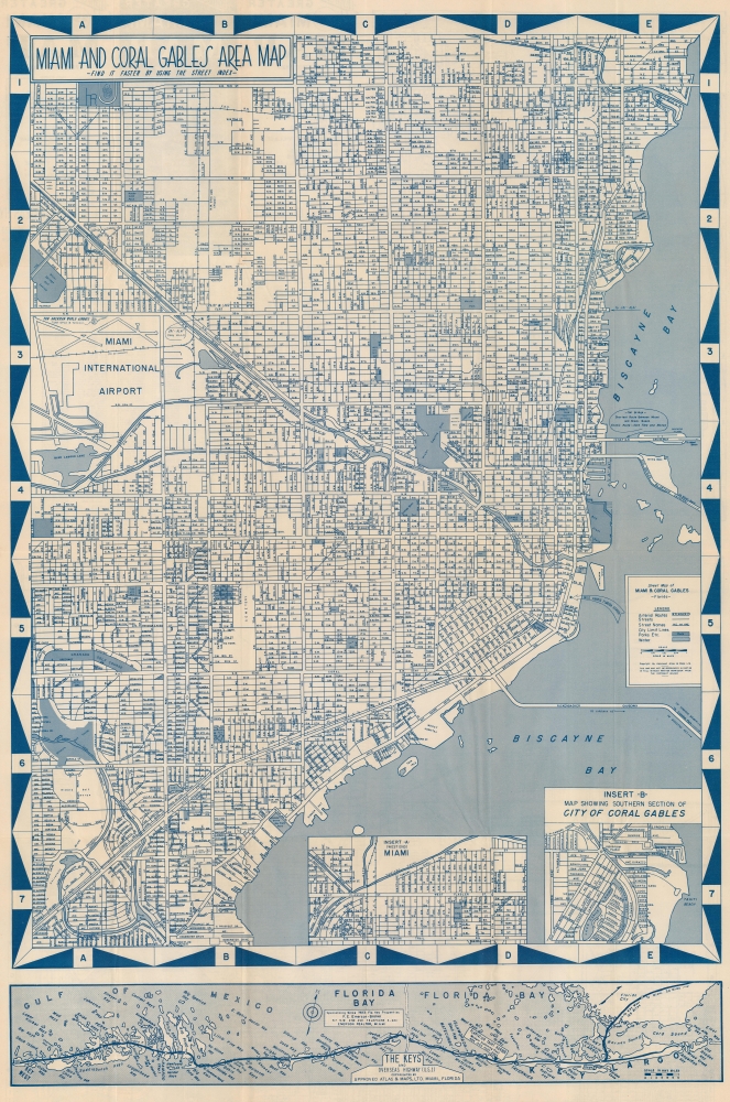
Miami and Coral Gables Area Map.
1950 (undated) 32 x 21.25 in (81.28 x 53.975 cm) 1 : 46080
1950 (undated) 32 x 21.25 in (81.28 x 53.975 cm) 1 : 46080
Description
This is a striking cyan-toned c. 1950 'Approved Atlas and Maps' city map of Miami and Coral Gables, Florida. Streets are labeled throughout, along with the Florida East Coast Railroad. Golf courses, city parks, and the Orange Bowl are marked. Two insets focus on the West End of Miami and southern Coral Gables. A smaller map along the bottom border illustrates the Overseas Highway from Key Largo to Key West.
Publication History and Census
This map was created and published by the Approved Atlas and Maps c. 1950. This is the only known cataloged example.Cartographer
Approved Atlas and Maps Ltd. (fl. c. 1948 - 1951) was a map and atlas publishing firm based in Miami, Florida. The firm produced several plat-book atlases of Miami as well as at least one separately issued city plan of Miami and Coral Gables. More by this mapmaker...
Condition
Very good. Light wear along original fold lines. Verso repairs at two fold intersections.