This item has been sold, but you can get on the Waitlist to be notified if another example becomes available.
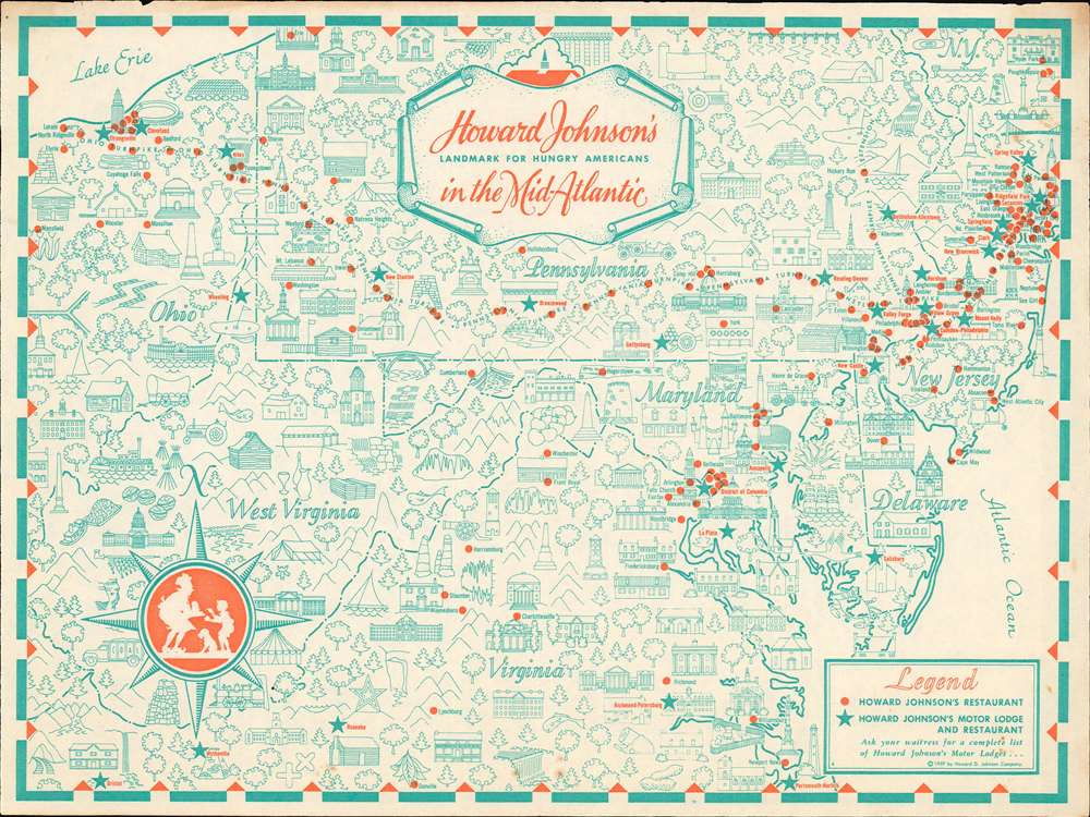
1959 Howard Johnson Pictorial Placemat Map of the Mid-Atlantic States
MidAtlantic-howardjohnson-1959$75.00

Title
Howard Johnson's Landmark for Hungry Americans in the Mid-Atlantic.
1959 (dated) 10 x 13.5 in (25.4 x 34.29 cm)
1959 (dated) 10 x 13.5 in (25.4 x 34.29 cm)
Description
This is a 1959 Howard Johnson's pictorial placemat map of the Mid-Atlantic states. Promoting Howard Johnson's restaurants and motor lodges, the map depicts the region from Ohio to the Atlantic Ocean and from Poughkeepsie, New York to Norfolk, Virginia. Without question, Howard Johnson's wants to bring the viewer's attention to their many restaurant locations along the Ohio, Pennsylvania, and New Jersey Turnpikes, all of which are marked by red dots. Stars promote Howard Johnson's Motor Lodge and Restaurant, presumably where travelers could not only eat, but also book a room to spend the night. Illustrations of buildings, lighthouses, trees, and even golf courses create an 'I Spy'-like aesthetic that most likely engrossed children, allowing their parents a brief respite as they waited for their meal.
Publication History and Census
This map was created and published by the Howard D. Johnson Company in 1959. An example is part of the David Rumsey Map Collection.Condition
Very good. Exhibits light toning along margins.
References
Rumsey 11412.000.