This item has been sold, but you can get on the Waitlist to be notified if another example becomes available, or purchase a digital scan.
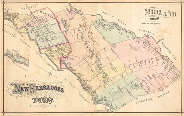
1876 Walker Map of Midland & New Barbadoes, New Jersey
MidlandNewBarbadoes-walker-1876$87.50

Title
New Baradoes Township. Midland Township.
1876 (undated) 16.75 x 27.25 in (42.545 x 69.215 cm)
1876 (undated) 16.75 x 27.25 in (42.545 x 69.215 cm)
Description
Very detailed map of New Barbadoes and Midland Townships, New Jersey, in 1876, showing roads and property boundaries and owners' names. Notable too is the early depiction of school district boundaries in a state that today publicizes the high quality of its schools in the context of property values. On verso appear absolutely lovely lithographic views of the First Reformed Church of Hackensack, and the County Court House and Jail of Hackensack (plates 42 & 39, respectively, on facing pages). Published as plates 40-41 in Walker & Pease' exquisite 'topographical, illustrated, historical, descriptive' Atlas of Bergen County, New Jersey, 1876.
Source
Walker, A. H., and Pease, C. C. Atlas of Bergen County, New Jersey, 1876.
Condition
Good. Even overall toning. Original centerfold exhibits some wear and in verso reinforcement. Minor discolorations here and there. Edge wear mostly confined to margins.
References
Phillips (Atlases) #2152.