This item has been sold, but you can get on the Waitlist to be notified if another example becomes available.
1954 Florida State Map of the Florida Keys, Monroe County, Florida
MonroeCountyHighways-roaddepartment-1954$100.00

Title
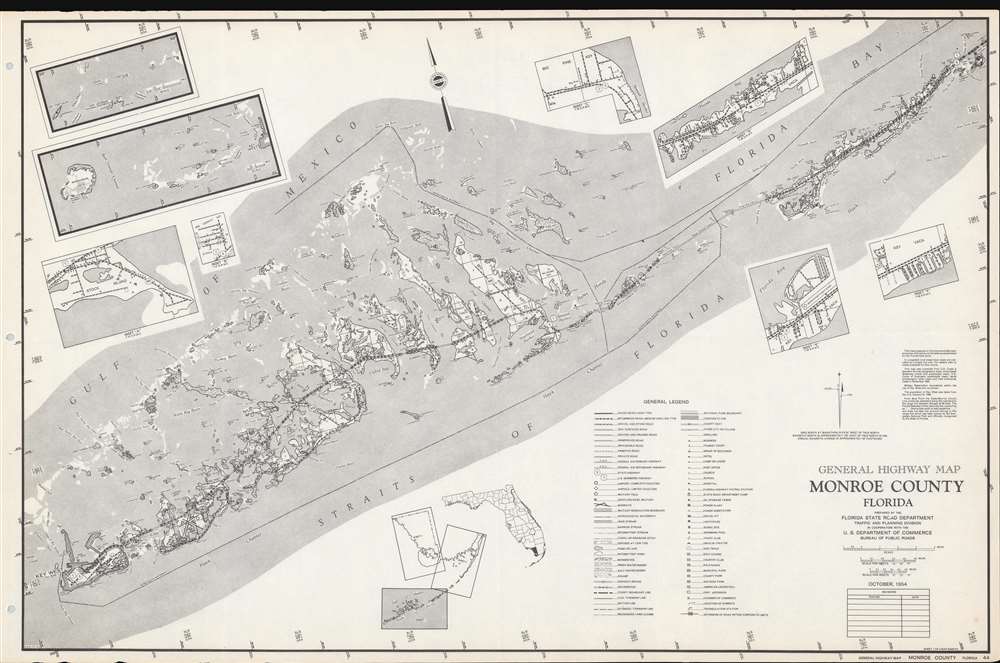
General Highway Map Monroe County, Florida.
1954 (dated) 18 x 27.5 in (45.72 x 69.85 cm) 1 : 126720
1954 (dated) 18 x 27.5 in (45.72 x 69.85 cm) 1 : 126720
Description
This is a 1954 Florida State Road Department map the Florida Keys in Monroe County. Depicting from Conch Key to Key West, the Florida Overseas Highway acts as the main focal point. Keys, bays, points, banks, channels, shoals, sounds, and other features are illustrated and labeled. Eight inset maps provide additional focused detail. These include Stock Island, Big Coppitt Key, the Marquesas Keys west of Key West, Dry Tortugas, and Big Pine Key. Three insets focus on Key Vaca, including Marathon. A key situated in the lower right summarizes notations and sources.
Publication History and Census
This map was created and published by the Traffic and Planning Division of the Florida State Department of Roads in cooperation with the Bureau of Public Roads of the U.S. Department of Commerce in October 1954. The present map is Sheet 1 of a three sheet series. We note a single example cataloged in OCLC, part of the collection at the University of Florida.Condition
Very good.
References
OCLC 20001234.