This item has been sold, but you can get on the Waitlist to be notified if another example becomes available, or purchase a digital scan.
1906 Cortesi Large-Scale map of Montevideo, Uruguay
Montevideo-cortesi-1906$2,250.00


Title
Plano del Departamento de Montevideo construido con los datos mas recientes.
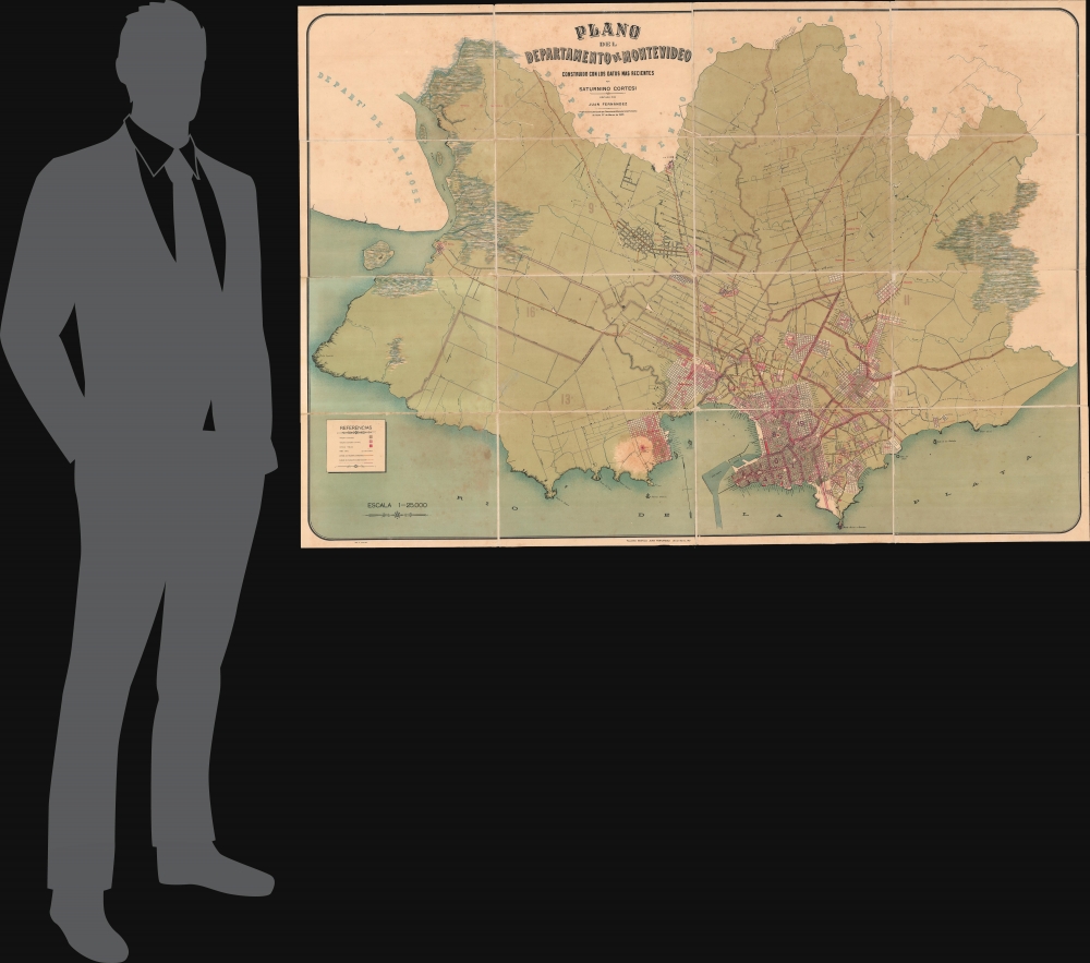
1906 (dated) 42 x 61 in (106.68 x 154.94 cm) 1 : 25000
1906 (dated) 42 x 61 in (106.68 x 154.94 cm) 1 : 25000
Description
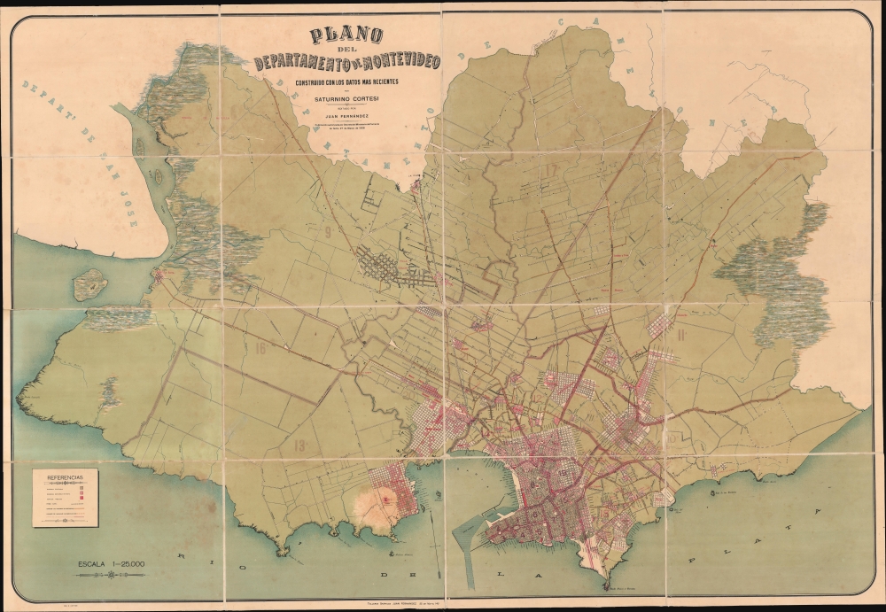
This extraordinary large-scale 1906 Saturnino Cortesi chromolithograph map of Montevideo illustrates the Uruguayan capital at the height of its early 20th century golden age. Cortesi's work is significant as it provides insights into Montevideo's development and the nation's geographical layout during a time of rapid growth and urbanization. Coming out of the 19th century, Montevideo enjoyed sustained economic prosperity, widespread immigration, and the progressive José Batlle y Ordoñez government led to explosive urban and cultural growth. This official government plan was intended to guide the development of new barrios, boulevards, grand squares, monumental edifices, and modern infrastructure, all of which are detailed.
A Closer Look
The map embraces the full Department of Montevideo. Development radiates out from the urban center, with the rural areas extending into the interior. The Referencias' (key), in the lower left corner, details stages of development across various new barrios, including: Manzanas Edificadas (gray: fully built-up blocks); Manzanas Edificadas en Parte (pink: partially built-up urban blocks); and Edificios Públicos (red: public buildings). It also notes infrastructure, including the Ferro Carril (railroads), Caminos de Macadam ó Empredados (macadamized roads), Caminos de Macadam en Construccion (macadamized roads under construction), and Limites de las secciones judiciales (boundaries of judicial districts). Around the borders there are several beautifully rendered Bañados (swamps).Historical Context
Founded by the Spanish in 1724, Montevideo, Uruguay's capital, underwent transformative growth in the late 19th and early 20th centuries. After enduring the tumultuous Guerra Grande (1843 - 51), the city embraced modernization, connecting to the rest of the country through railways by 1869 and establishing several new neighborhoods. By the early 20th century, under President José Batlle y Ordoñez's leadership from 1903, Montevideo experienced a golden era marked by an influx of European immigrants, a doubling of its population to 500,000 by 1930, and a construction boom that shaped its modern identity.Chromolithography
Chromolithography, sometimes called oleography, is a color lithographic technique developed in the mid-19th century. The process involved using multiple lithographic stones, one for each color, to yield a rich composite effect. Oftentimes, the process would start with a black basecoat upon which subsequent colors were layered. Some chromolithographs used 30 or more separate lithographic stones to achieve the desired product. Chromolithograph color could also be effectively blended for even more dramatic results. The process became extremely popular in the late 19th and early 20th centuries when it emerged as the dominant method of color printing. The vivid color chromolithography produced made it exceptionally effective for advertising and propaganda imagery.Publication History and Census
This map was commissioned in 1904 by the Uruguayan government, compiled by Saturnino Cortesi, then printed in 1906 in Montevideo by Talleres Gráficos Juan Fernández. It is extremely rare. We note examples only in the David Rumsey Collection and at the University of Wisconsin-Milwaukee.CartographerS
Saturnino Cortesi (fl. c. 1900 - 1925) was a Uruguayan geographer active in the late 19th and early 20th century. In 1903 he, along with Anibal Méndez, was commissioned by the president of Uruguay, José Batlle y Ordoñez, to compile a large-scale official national map of Uruguay. He also issued a large wall map of the department of Montevideo in 1906. In addition, he published educational geographical texts in 1905 and 1908. More by this mapmaker...
Juan Fernández (fl. c. 1900 - 1911) was a Uruguayan lithographer based in Montevideo. His firm, Talleres Gráficos Juan Fernández produced some of the most significant maps of Uruguay and Montevideo in the 19th century, including Saturnino Cortesi's definitive official plan of that city. The firm specialized in graphic printing, chromolithography, and photolithography. Learn More...
Condition
Good. Laid on original linen, with binder. Some foxing and overall toning. Wear along old dissection lines. Stable.
References
Rumsey 15302.000. OCLC 1373777393. Boletin de la Biblioteca 'América' de la Universidad de Santiago de Compostela (España), (1910), p. 69. Instituto Histórico y Geográfico del Uruguay, Revista del Instituto Histórico y Geográfico del Uruguay, vol. 3 (1923), p. 246. Revista de la Instituto de agronomïa de Montevideo, Volumes 9-12 (1911), p. 40. Uruguay - Inspección General de Marina, Catálogo del archivo cartográfico histórico, (1956), p. 273.