1939 Furse Map or Plan of the City of Montreal, Quebec, Canada
Montreal-furse-1939$225.00

Title
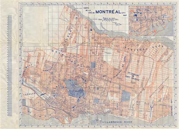
Carte de la Cite de Montreal City Map.
1939 (undated) 24 x 33 in (60.96 x 83.82 cm) 1 : 35000
1939 (undated) 24 x 33 in (60.96 x 83.82 cm) 1 : 35000
Description
This is an attractive map or plan of the city of Montreal by Charles F. Furse published in c.1939. This plan covers Montreal from Montreal-West and La Salle north to Montreal East. Identifies several important landmarks, individual streets, parks, squares, railways, piers and topographic details. The map includes the city of St. Leonard de Port Maurice (modern day Saint-Leonard), which at the time was a separate city. St. Helen's Park, which was converted into a public park in 1874, is identified. Isle Ronde, or the Round Island, near St. Helen's Island is here identified as a separate island. This island was connected to St. Helen's island with soil excavated during the construction of the Montreal Metro. An inset of downtown Montreal is included in the top right quadrant. Accompanied by guidebook containing the street index. This map was created by Charles F. Fruse and published by ‘The Province of Quebec Tourism Association’.
Condition
Very good. Minor wear along original fold lines.
References
OCLC: 38264140.