1949 Map of Montserrat, near Barcelona, Catalonia, Spain
Montserrat-desemir-1949$150.00


Title
Mapa de Montserrat.
1949 (dated) 28.5 x 35.75 in (72.39 x 90.805 cm) 1 : 10000
1949 (dated) 28.5 x 35.75 in (72.39 x 90.805 cm) 1 : 10000
Description
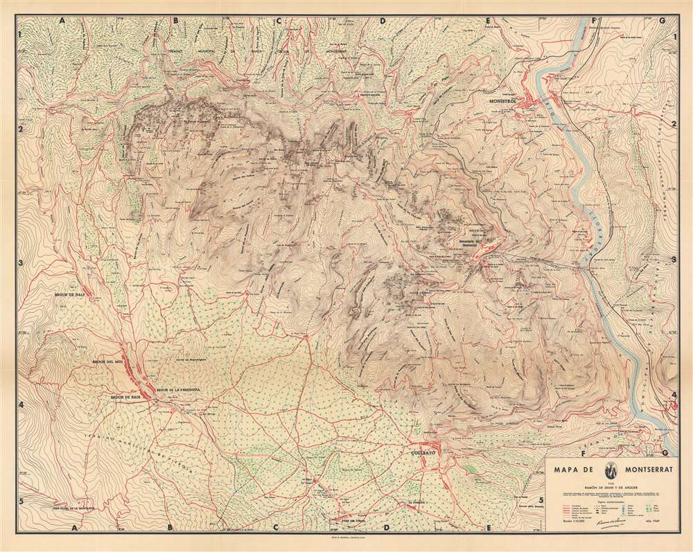
Smartly combining aesthetics and utility, this is Ramón de Semir's 1949 map of Montserrat and environs, outside Barcelona in Catalonia. It depicts the dramatic topography of the region in remarkable detail while noting adjacent villages, transportation lines, orchards, and vineyards.
The two most immediate features of this map are its coloration, reflecting the pinkish rock of the landscape itself, and the density of contour lines, highlighting the steep topography of the peaks that rise hundreds of meters in the span of a handful of kilometers. The famous abbey is located at right-center, with connections by road, rail (a rack or cog railway), funicular, and aerial cable car (Aéreo de Montserrat).
Little towns (ermita), churches, caves (cueva), and viewpoints (miranda and mirador) are scattered around the mountain. To the west are vineyards, olive trees, and pine groves. To the right is the Rio Llobregat, the second longest river in Catalonia, which flows into the Mediterranean at Barcelona. A legend at bottom-right indicates signage used, while an alphanumeric grid surrounds the map, allowing for the easy location of specific points. A note below the title explains that more than a decade of laborious surveying work went into the production of the map (no doubt interrupted by Spain's civil war) and that some input on the toponyms came from the monks of the Benedictine abbey.
A Closer Look
Located northwest of Barcelona, the mountain peaks depicted here should not be confused with the island of the same name in the Lesser Antilles, which Columbus named after the mountain, or the similarly names Montserrate that rises above Bogotá, Colombia. Montserrat means 'serrated mountain,' referring to the peaks' distinctive saw-like appearance. It is among the most important religious and cultural sites in Catalonia, particularly due to the ancient Benedictine Santa Maria de Montserrat abbey located there, which houses Our Lady of Montserrat, a statue of the Virgin Mary and Child. In recent decades, the mountain complex has increasingly been used for recreation (Montserrat was made a national park in 1987). Harkening back to the history of pilgrimage on the mountain, hiking is especially popular.The two most immediate features of this map are its coloration, reflecting the pinkish rock of the landscape itself, and the density of contour lines, highlighting the steep topography of the peaks that rise hundreds of meters in the span of a handful of kilometers. The famous abbey is located at right-center, with connections by road, rail (a rack or cog railway), funicular, and aerial cable car (Aéreo de Montserrat).
Little towns (ermita), churches, caves (cueva), and viewpoints (miranda and mirador) are scattered around the mountain. To the west are vineyards, olive trees, and pine groves. To the right is the Rio Llobregat, the second longest river in Catalonia, which flows into the Mediterranean at Barcelona. A legend at bottom-right indicates signage used, while an alphanumeric grid surrounds the map, allowing for the easy location of specific points. A note below the title explains that more than a decade of laborious surveying work went into the production of the map (no doubt interrupted by Spain's civil war) and that some input on the toponyms came from the monks of the Benedictine abbey.
Publication History and Census
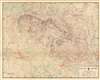
This map was made by Ramón de Semir y de Arquer and published by Seix Barral in Barcelona in 1949. It is only cataloged among the holdings of the Biblioteca Nacional de España, the Consejo Superior Investigaciones Científicas, and the Universitat de Barcelona.CartographerS
Ramón de Semir y de Arquer (fl. c. 1934 – 1995) was a cartographer and author who produced maps of Catalonia, especially its mountains, for tourists and hikers. More by this mapmaker...
Seix Barral (1911 – present) is a Barcelon-based publisher that has long been among the most prominent Spanish-language publishers in the world. Founded as a graphic arts company, it soon moved into publishing and was an early proponent of postwar Latin American poets and authors writing in Spanish, publishing works by Jorge Luis Borges, Pablo Neruda, and Octavio Paz, among others. In 1982, Seix Barral became a part of Grupo Planeta but maintains its name and distinct identity. Learn More...
Condition
Very good. Slight creasing along fold lines.
References
OCLC 431278230, 892218101.