1891 Roy Pictorial Map of Paris, France and its Monuments
MonumentalParis-roy-1891$750.00

Title
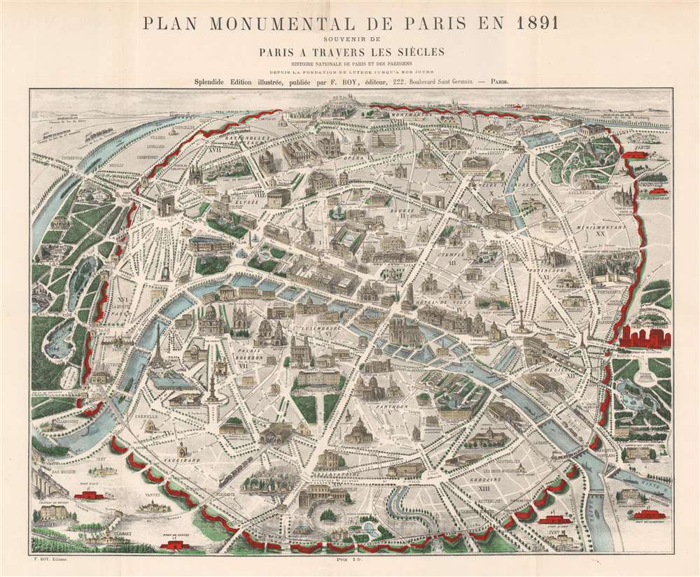
Plan Monumental de Paris en 1891.
1891 (dated) 18.25 x 21.5 in (46.355 x 54.61 cm)
1891 (dated) 18.25 x 21.5 in (46.355 x 54.61 cm)
Description
This is an 1891 F. Roy pictorial map of Paris, France highlighting the city's historical architecture. The Eiffel Tower, opened only two years earlier, appears along the Seine not far from the Bois de Boulogne (shaded a lovely green) and the Palais du Trocadéro (destroyed in 1936). The rest of Paris's gardens and parks, including the Jardin des Tuileries, the Parc des Buttes-Chaumont, and the Jardin du Luxembourg, are shaded the same striking shade of green. The Arc de Triomphe, the Louvre, Notre Dame, the Panthéon, and Les Invalides are illustrated, along with Paris's churches, museums, government buildings, and train stations. Pere Lachaise, the famous cemetery, is situated to the right of Paris. Paris's walls (now replaced by the Boulevard Périphérique) stand out in bright red.
Publication History and Census
This map was published by F. Roy in 1891 to accompany Nicola-Jules-Henri Gourdon de Genouillac's Paris à Travers Les Siècles. This piece is not cataloged in OCLC and we have not located any other cataloged examples.Condition
Very good. Light wear along original fold lines. Closed margin tears professionally repaired on verso.