This item has been sold, but you can get on the Waitlist to be notified if another example becomes available, or purchase a digital scan.
1920 City Plan or Map of Mosul, Iraq in Arabic
Mosul-unknown-1910$600.00

Title
Mosul. / الموصل
1910 (undated) 17.75 x 26 in (45.085 x 66.04 cm) 1 : 5000
1910 (undated) 17.75 x 26 in (45.085 x 66.04 cm) 1 : 5000
Description
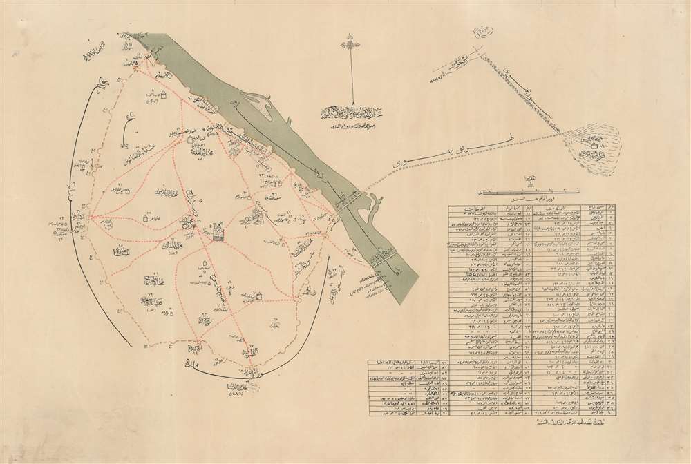
This is a c. 1910 city plan or map of Mosul, Iraq composed entirely in Arabic by an unknown cartographer. Situated along the west bank of the Tigris River, Mosul is a major city in northern Iraq. Religious sites throughout the city are identified, including mosques and some Christian sites. Every location is numerically identified and corresponds with a table situated in the lower right.
Brown ink marks Mosul's old city walls, surrounding the city on all sides with the exception of the side of the city facing the river. The area on the opposite bank from Mosul likely illustrates the ancient city of Nineveh.
Great Mosque of al-Nuri
The Great Mosque of al-Nuri is one of the map's focal points, appearing at the approximate center of the city. According to tradition, the Great Mosque was constructed in the 12th century. It was destroyed by the Islamic State of Iraq and the Levant (ISIL) in 2017.Brown ink marks Mosul's old city walls, surrounding the city on all sides with the exception of the side of the city facing the river. The area on the opposite bank from Mosul likely illustrates the ancient city of Nineveh.
Publication History and Census
Unique. We have identified no other examples.Condition
Very good. Closed margin tears professionally repaired on verso. Closed tear extending one and one-half (1.5) inches in lower left quadrant professionally repaired on verso and does not effect printed area.