This item has been sold, but you can get on the Waitlist to be notified if another example becomes available, or purchase a digital scan.
1850 Meyer Comparative Chart of World Mountains
Mountains-meyer-1850$50.00

Title
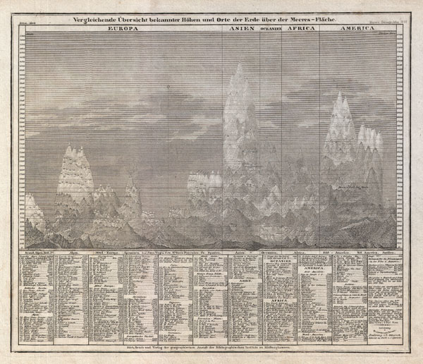
Vergleichende Übersicht bekannter Höhen und Orte der Erde über der Meeres-Fläche
c. 1850 (undated) 9 x 10.5 in (22.86 x 26.67 cm)
c. 1850 (undated) 9 x 10.5 in (22.86 x 26.67 cm)
Description
An interesting c. 1850 German take on the comparative mountains chart by Joseph Meyer. Identifies some 400 mountains drawn in proximity to one another and subdivided by continent. Dhaulagiri, in the Nepali Himalayas is identified as the world's greatest peak. The names and elevations of the various other peaks shown are identified textually at the base of the chart proper. Published in Meyer's c. 1850 Groschen-Atlas.
Source
Meyer, J., Meyer's Groschen-Atlas aller Länder uns Staaten der Erde, mit Physikalischen und Himmels-Karten in 154 Blättern, 1850.
Condition
Very good. Blank on verso.