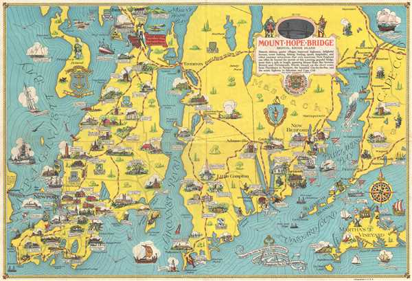
This item below is out of stock, but another example (left) is available. To view the available item, click "Details."
Details
1933 Haley / Hetherington Pictorial Map of Rhode Island and Massachusetts
1933 (dated) $450.00
1939 Haley and Hetherington Pictorial Map of Rhode Island and Massachusetts
MountHopeBridge-haley-1939
Title
1939 (dated) 17.25 x 25.75 in (43.815 x 65.405 cm) 1 : 105000
Description
This map was arranged by John W. Haley, designed by H. W. Hetherington, lithographed by the J. C. Hall Company and copyrighted by the Mount Hope Bridge Corporation in 1939. The map is quite scarce today and rarely appears on the market.
Cartographer
John Williams Haley, Sr. (1897 - 1963) was the former vice president of the Narragansett Brewing Company and the Rhode Island historian for over 25 years. He was best known for his weekly radio program, 'The Rhode Island Historian', which ran from 1927 until about 1953. The Providence Institute for Savings ('The Old Stone Bank') published several hundred of his radio scripts in pamphlet form and many were reprinted later in the four-volume Old Stone Bank History of Rhode Island. More by this mapmaker...

