1930 Rose Palmer Hand-Drawn Pictorial Map of Nantucket, Massachusetts
Nantucket-rosepalmer-1930$1,300.00

Title
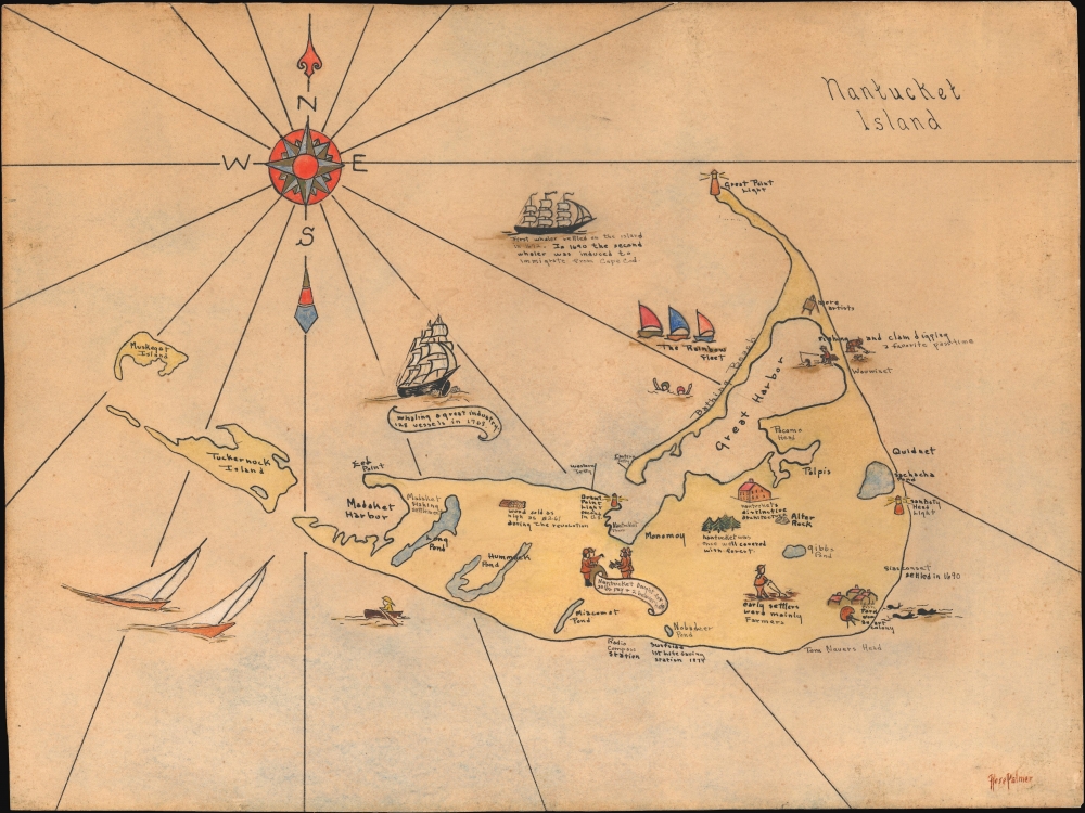
Nantucket Island.
1930 (undated) 12 x 16 in (30.48 x 40.64 cm) 1 : 92000
1930 (undated) 12 x 16 in (30.48 x 40.64 cm) 1 : 92000
Description
This is a unique and utterly charming c. 1930s manuscript pictorial and historical map of Nantucket Island, Massachusetts, by Rose Palmer. This is one of the few period maps that identifies Cod Fish Park as an artist colony.
A Closer Look
Coverage embraces the island of Nantucket as well as nearby Tuckernuck and Muskeget Islands. Major landmarks, including Nantucket Town, are noted, but most of the content focuses on historical vignettes: Whaling ships, early settlers, and Revolutionary War events. It also notes recreational activities, such as the bathing beach, Nantucket's famous Rainbow Fleet, and clam digging. The view is dated somewhat by the identification of 'Cod Fish Park now an art colony' just south of Siasconset. While originally a ramshackle settlement of tiny fish shacks, Cod Fish Park developed into an impromptu artist colony in the 1920s and remained so until about 1940. This map almost certainly dates from this period.Publication History and Census
This is a unique hand-drawn map by Rose Palmer. Palmer's name being somewhat common, we have been unable to identify her further. It is the only known example.Condition
Very good. Edge wear. Even overall toning.