1943 Army Orientation Branch Map of the Dutch East Indies
NetherlandsEastIndies-orientation-1943$150.00

Title
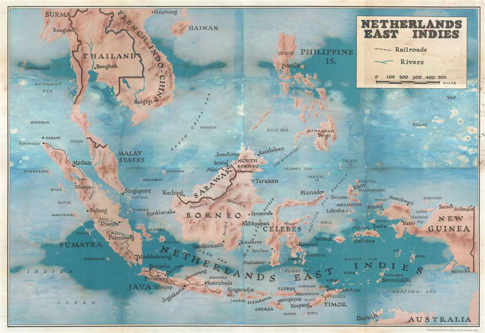
Netherlands East Indies.
1943 (undated) 37 x 53.5 in (93.98 x 135.89 cm) 1 : 4500000
1943 (undated) 37 x 53.5 in (93.98 x 135.89 cm) 1 : 4500000
Description
This is a c. 1943 Army Orientation Branch map of the East Indies. Depicting the region from the Indian Ocean to New Guinea and from Hainan and French Indochina to northern Australia, maps like this one created by the Army Orientation Branch were meant to help educate soldiers about where World War II was being fought in a general sense. Major cities are marked throughout, including Haiphong, Saigon, Darwin, Manila, Singapore, and Batavia. No information about the current state of the fighting is included, likely because these maps were meant to be used as educational aids in classes and the war front was constantly fluid.
Why the Army Orientation Branch Created This Map
Per 'The Digest', a magazine published by the Research Branch of the Army Information and Education Division, the Army Orientation Branch created these maps for inclusion in Orientation Kits that were used to teach the Army Orientation Course. These kits were distributed by the Education Division to unit Information-Education officers on a basis of one kit for every 200 men. These Information-Education officers could not order additional copies of any of the maps and could not request one of the kits directly from the Education Division. Education kits were forwarded from The Pentagon to 'Service Commands, Air Bases, Posts, Corps, Camps, Stations, and Divisions.' When shipping a kit to one of the Theaters of Operation, they were 'sent to the Port of Embarkation for each theater.' As such, Information-Education officers were told to send requests for kits to 'their next highest command who will further endorse the request if necessary.'Publication History and Census
This map was created by the Army Orientation Branch c. 1943. The OCLC catalogues examples as being part of the collections at Brown University, the University of Michigan, the University of Illinois at Urbana Champaign, Haverford College.Cartographer
The Army Orientation Branch (1940 - c. 1949) created special maps for teaching the Army Orientation Course and was based at The Pentagon in Washington, D.C. The Army Orientation Branch was part of the Information and Education Division. More by this mapmaker...
Condition
Average. The map exhbits extensive color loss where once exposed to water. Blank on verso. Still we think it has charm. Priced accordingly.
References
OCLC 63795081.