
This item below is out of stock, but another example (left) is available. To view the available item, click "Details."
Details
1890 Bartholomew Map of Queensland and South Australia, Australia
1890 (undated) $75.00
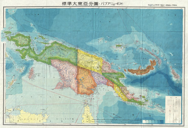
1943 World War II Japanese Aeronautical Map of New Guinea
NewGuinea14-wwii-1943$142.50

Title
New Guinea.
1943 (undated) 20 x 29 in (50.8 x 73.66 cm)
1943 (undated) 20 x 29 in (50.8 x 73.66 cm)
Description
A stunning large format Japanese map of New Guinea dating to World War II. Covers the entirety of the island with color coding according to district. Offers superb detail regarding both topographical and political elements. Notes cities, roads, trade routes on air, sea and land, and uses shading to display oceanic depths. All text in Japanese. While Allied World War II maps of this region are fairly common it is extremely rare to come across their Japanese counterparts. This map was created as map no. 14 of a 20 map series detailing of parts of Asia and the Pacific prepared by the Japanese during World War II.
Condition
Very good condition. Original folds, as issued. Blank on verso.