This item has been sold, but you can get on the Waitlist to be notified if another example becomes available, or purchase a digital scan.
1876 Walker Map of New Jersey
NewJersey-walker-1876$87.50

Title
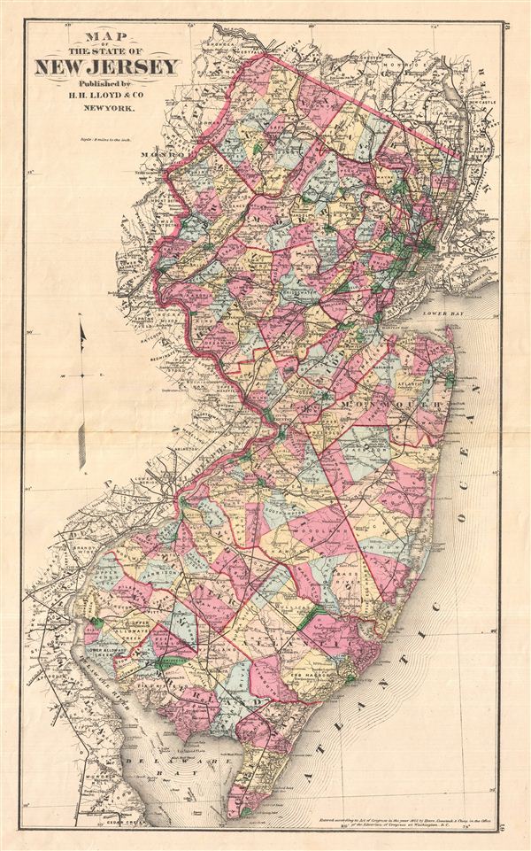
Map of the State of New Jersey
1876 (undated) 23 x 14 in (58.42 x 35.56 cm)
1876 (undated) 23 x 14 in (58.42 x 35.56 cm)
Description
A fine double page 1876 map of New Jersey drawn by H. H. Lloyd and, copyrighted by Frederick Beers, and published by Walker & Pease. Covers the entire state with color coding according to county. Shows major roadways and railways as well as basic topographical features. Published in Walker & Pease' exquisite centennial 'topographical, illustrated, historical, descriptive' Atlas of Bergen County, New Jersey, 1876.
Source
Walker, A. H., and Pease, C. C. Atlas of Bergen County, New Jersey, 1876.
Condition
Good. Even overall toning. Original centerfold exhibits some wear and in verso reinforcement. Minor discolorations here and there. Edge wear mostly confined to margins.
References
Phillips (Atlases) #2152.