This item has been sold, but you can get on the Waitlist to be notified if another example becomes available, or purchase a digital scan.
1892 Rand McNally Map or Plan of New Orleans, Louisiana
NewOrleans-randmcnally-1893$50.00

Title
Map of New Orleans.
1892 (dated) 20 x 13 in (50.8 x 33.02 cm) 1 : 30500
1892 (dated) 20 x 13 in (50.8 x 33.02 cm) 1 : 30500
Description
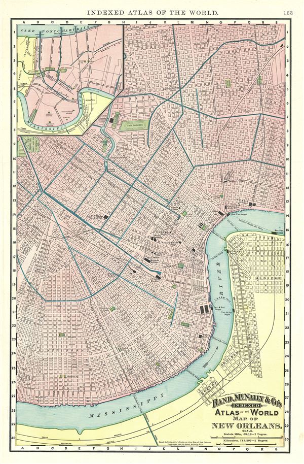
An attractive 1892 map or plan of the city of New Orleans, Louisiana, issued by Rand McNally and Company. It covers the city from the Mississippi River north as far as Monroe St. and from Firemens Cemetery east to Algiers. The map is highly detailed and notes individual streets and important buildings throughout, including the U.S. Marine Hospital, Mint, House of Refuge, etc. Parks, railway and ferry lines, squares and other topographical features are also noted. An inset in the upper left quadrant features New Orleans in its entirety with railway lines marked. This map was issued as plate no. 163 in the 1893 edition of Rand McNally and Company's Indexed Atlas of the World- possibly the finest atlas Rand McNally ever issued.
Cartographer
Rand, McNally and Co. (fl. 1856 - present) is an American publisher of maps, atlases and globes. The company was founded in 1856 when William H. Rand, a native of Quincy, Massachusetts, opened a print shop in Chicago. Rand hired the recent Irish immigrant Andrew McNally to assist in the shop giving him a wage of 9 USD per week. The duo landed several important contracts, including the Tribune's (later renamed the Chicago Tribune) printing operation. In 1872, Rand McNally produced its first map, a railroad guide, using a new cost effective printing technique known as wax process engraving. As Chicago developed as a railway hub, the Rand firm, now incorporated as Rand McNally, began producing a wide array of railroad maps and guides. Over time, the firm expanded into atlases, globes, educational material, and general literature. By embracing the wax engraving process, Rand McNally was able to dominate the map and atlas market, pushing more traditional American lithographic publishers like Colton, Johnson, and Mitchell out of business. Eventually Rand McNally opened an annex office in New York City headed by Caleb S. Hammond, whose name is today synonymous with maps and atlases, and who later started his own map company, C. S. Hammond & Co. Both firms remain in business. More by this mapmaker...
Source
Rand McNally & Co., Rand, McNally & Co's Indexed Atlas of the World, (Chicago) 1893.
Condition
Very good. Text on verso.
References
Rumsey 3565.099 (1897 edition). Philips (atlases) 1026 (1898 edition).