1846 Burr City Plan or Map of Manhattan, New York City
NewYork-burr-1846$900.00


Title
Map of the City of New-York. Drawn by D.H. Burr for 'New York as it is in 1846'.
1846 (undated) 12.75 x 10.75 in (32.385 x 27.305 cm)
1846 (undated) 12.75 x 10.75 in (32.385 x 27.305 cm)
Description
This is an 1846 David Hugh Burr and 'Homans and Ellis' city map of Manhattan, New York City.
A Closer Look
Coverage includes Manhattan from Kip's Bay to the Battery. Parks break up Manhattan's iconic street grid and Brooklyn Heights appears along the bottom border. Farther towards the Battery, the unplanned knot of streets is a reminder of New York's beginnings as a rough and ready colonial trade center. Squares and parks interrupt these thoroughfares, along with the Alms House and Bellevue Hospital along the East River. The docks along the East River and up the Hudson River are numbered, with ferry and steamboat routes illustrated by dotted lines and labeled with their destinations. Brooklyn and Williamsburg occupy the lower right corner, and 12 public buildings in Brooklyn are numerically identified. City wards in both Manhattan and Brooklyn are shaded different colors to allow for easy differentiation.Provenance
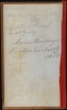
Faded manuscript pencil appears on the inside of the cardboard binder accompanying the map. While the owner's name has become too faded to read, one can clearly read 'Bought…1846 in N.Y. City'. A second notation below reads 'Moses Huntington Partial Erie Co. N.Y. 1868'. This later figure is likely the Moses Huntington (1797 - 1885) who lived in Erie Country, New York, at this time.Publication History and Census
This map was drawn by David Hugh Burr and published by Homans and Ellis in 1846. We note examples at: the New York Public Library, the New York Historical Society, the Library of Congress, New York State Library, and the Bibliotheek Universiteit van Amsterdam. At least two editions were published: one in Edward Ruggles' Picture of New York in 1846 and another, as here, separately published.Cartographer
David Hugh Burr (August 18, 1803 - December 25, 1875) of one of the first and most important truly American cartographers and map publishers. Burr was born in Bridgeport Connecticut in August of 1803. In 1822 Burr moved to Kingsboro, New York to study law. A year and a half later he was admitted to the New York Bar association. Burr must have questioned his choice of careers because shortly after being admitted to the Bar, he joined the New York State Militia. Though largely untrained in the art of surveying, Burr was assigned to work under Surveyor General of New York, Simeon De Witt, to survey several New York Roadways. Seeing a window of opportunity, Burr was able to negotiate with the governor of New York at the time, De Witt Clinton, to obtain copies of other New York survey work in order to compile a map and Atlas of the state of New York. Recognizing the need for quality survey work of its territory, the government of New York heartily endorsed and financed Burr's efforts. The resulting 1829 Atlas of the State of New York was the second atlas of an individual U.S. state and one of the most important state atlases ever produced. Burr went on to issue other maps both of New York and of the United States in general. In cooperation with publishing firm of Illman & Pillbrow, he produced an important New Universal Atlas and, with J.H. Colton, several very important maps of New York City. In recognition of this work, Burr was appointed both "Topographer to the Post office" and "Geographer to the House of Representatives of the United States". Later, in 1855, Burr was assigned to the newly created position of Surveyor General to the State of Utah. Burr retired from the position and from cartographic work in general in 1857 when light of some of his financial misdeeds and frauds came to light. He was accused of submitting false expense reports and underpaying employees, among other indiscretions. More by this mapmaker...
Condition
Good. Backed on archival tissue for stability. Light wear along original fold lines. Repaired fold separations. Slight loss at a few fold intersections. Closed tear extending 2 inches into printed area in upper right corner professionally repaired on verso.
References
Haskell, D., Manhattan Maps: A Co-Operative List, 776. Museum of the City of New York 57.241.1. New York Public Library Map Div. 95-2591. OCLC 50444251.