This item has been sold, but you can get on the Waitlist to be notified if another example becomes available, or purchase a digital scan.
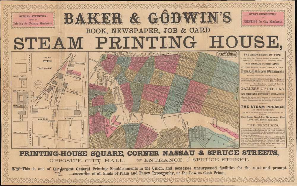
1860 Baker and Godwin Advertising Map of New York City
NewYorkCity-bakergodwin-1860$250.00

Title
Baker and Godwin's Book, Newspaper, Job and Card Steam Printing House. / Map of New York and Port o Brooklyn.
1860 (undated) 9.5 x 15.5 in (24.13 x 39.37 cm)
1860 (undated) 9.5 x 15.5 in (24.13 x 39.37 cm)
Description
An unusual ephemera map of New York City issued c. 1860 to promote the work of Baker and Godwin's steam printing. The map located at center is oriented to the west and covers New York from the Battery to Central Park, with adjacent parts of Brooklyn, Williamsburg, and Long Island City. Multiple ferry routes cross the Hudson. Adjacent to the main map a small er map focuses on the area around City Hall Park, including the triangle on Park Row known as Printing-House Square - this is essentially where the Brooklyn Bridge currently exits into Manhattan. The map is surrounded by promotional material advertising the printing firm, 'Baker and Godwin'. They were one of the first firms in New York to acquire a steam press - a tool that dramatically economized printing.
Publication History and Census
The map is undated, but based upon the printing style, paper, and geographical factors, it was likely issued around 1860. We have identified no other examples.Condition
Average. Pen marks. Laid on archival tissue to stabilize fold splits. Minor infill.