This item has been sold, but you can get on the Waitlist to be notified if another example becomes available, or purchase a digital scan.
1932 Freedman First Edition Bird's-Eye View SuperVue Map of New York City
NewYorkSupervue-freedman-1932$425.00

Title
Supervue of New York.
1932 (dated) 28 x 18.25 in (71.12 x 46.355 cm)
1932 (dated) 28 x 18.25 in (71.12 x 46.355 cm)
Description
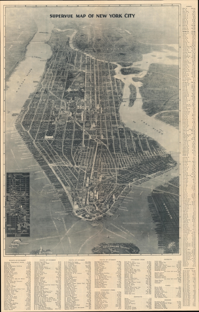
This is a spectacular 1932 first edition Edward V. Spofford / Samuel Freedman bird's-eye 'Supervue' map of New York City. Despite being issued at the height of the Great Depression, this view highlights New York City's resilience, prosperity, and multicultural dynamism.
A Closer Look
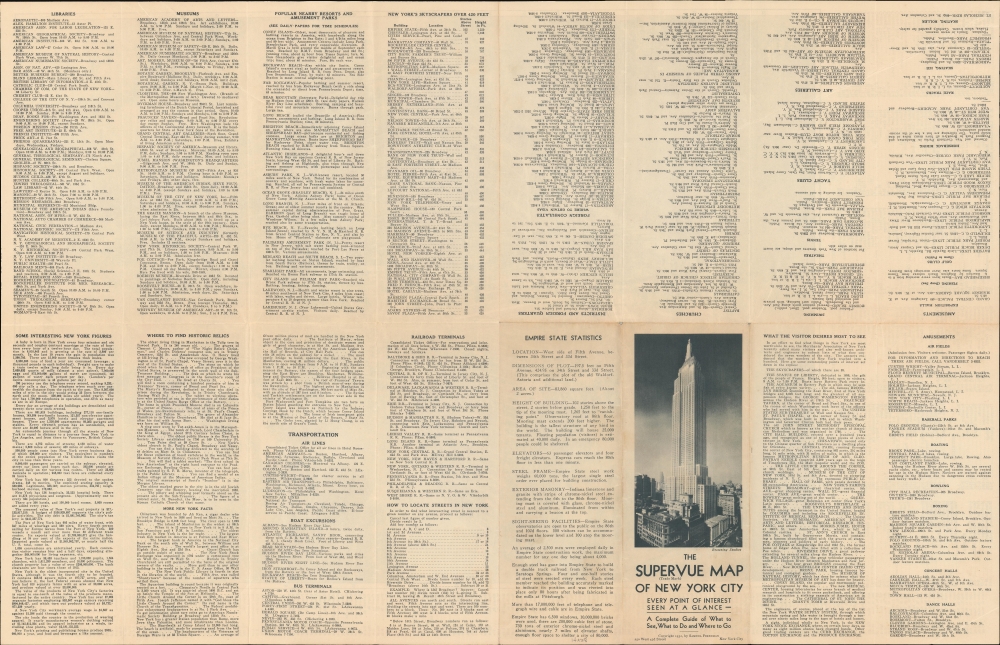
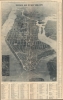
The view looks northwards on Manhattan from a presumptive point high above Governor's Island. Coverage stretches as far as Van Cortlandt Park, thus including much of the Bronx and parts of adjacent Queens, Brooklyn, and New Jersey. Important buildings appear in profile. Among them are bridges, the Empire State Building, the Chrysler Building, Grand Central Station, the Metropolitan Museum of Art, and more. Neighborhoods are labeled, including Greenwich Village, Little Italy, Chelsea, the Financial District, and the Theatre District. This last area, the Theater District, is further detailed via an inset in the lower left, in which specific theaters are named. Along the Hudson, passenger piers are labeled according to the carrier that operated them: White Star, Red Star, Cunard, Hudson River Night Line, etc. An index appears to the right and below the view. The verso offers an array of city-focused facts, trivia, and pointers regarding sightseeing highlights.Publication History and Census
The view is the work of Edward V. Spofford, printed and published by Samuel Freedman. The present example is the 1932 first edition, which is distinctly higher quality than subsequent editions. It is also the only edition to feature the Edward V. Spofford signature in the lower left - although Freedman maintained the copyright throughout the view's print run. Multiple editions followed until about 1940, most on glossy paper and reasonably common, but this is the first time we have encountered the 1932 edition, and it must be considered rare.CartographerS
Samuel Freedman (September 15, 1880 - 19xx) was a Russian-American printer and publisher active in New York City during the first half of the 20th century. Born in Bolnik, Lithuania, Freedman immigrated to the United States in 1887. Freedman owned his own printing shop by 1925 and continued to operate it through at least 1940. He was married to Anna Freedman, with whom he had at least three children, two daughters, and one son. We have been unable to locate any death records. More by this mapmaker...
Edward Wiltsie Spofford (August 29, 1863 - January 4, 1946) was an American commercial artist. He was born in Groveland, Massachusetts, in 1863. We have no record of his early education, but he appears as an engraver in Boston directories as early as 1883. He lived for a time in Chicago, but was active in New York from at least 1909, when he issued a series of views of Manhattan as seen from the deck of the Singer Tower. Spofford is noteworthy for developing a unique style of realistic high-perspective aerial view, which he called the 'supervue', likely based on the development of aerial photography in the early 20th century. His earliest view is a series of 1909 views of Manhattan as seen from the Singer Tower. Around this time, he also produced a view of Baltimore. He is best known for his 'Supervue of Manhattan', which enjoyed wide circulation in many formats from 1932 to the 1950s. His son, Edward V. Spofford (June 1894 - May 21, 1940) was also a commercial artist and may have collaborated with is father until his untimely 1940 death from a sudden cerebral hemorrhage. Learn More...
Condition
Very good. Light wear along original fold lines. Pinholes at some fold intersections. Promotional text on verso.