
1865 Viele Waterway Map of Manhattan, New York City, w/ Report



This item has been sold.
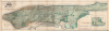
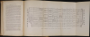
Sanitary and Topographical Map of the City and Island of New York Prepared for the Council of Hygiene and Public Health, of the Citizens Association.
One of the most beautiful, important, and enduring maps of Manhattan ever published.
- Digital Map Information
- Suitable for large format printing
- Full resolution TIFF file
- ICC color profile embedded
- Delivered instantly via download link
One of the most beautiful, important, and enduring maps of Manhattan ever published.
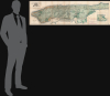
This is Egbert L. Viele's large-format 1865 topography and waterways map of Manhattan, or the City of New York as it was then. It is one of the scarcest, most important, and most enduring maps of New York City ever published. This particular example is a rare variant appearing in the Report of the Council of Hygiene and Public Health of the Citizens' Association of New York upon the Sanitary Condition of the City and also has the esteemed provenance of being connected to the French Consulate in New York City.A Closer Look
Covering the entirety of Manhattan Island, Viele's map details the canals, swamps, rivers, ditches, ponds, meadows, and drainage basins of Manhattan as they existed prior to the city's urban development. Color-shading is used to distinguish marshes, 'made land' (i.e. reclaimed land), and meadows. The city grid is overlaid on the hills and flora, including planned future development as far as 155th St., far beyond the existing built-up parts of the city. In the developed parts of the city (Lower and Midtown Manhattan), the sewer network is also illustrated. Central Park is noticeable near center; despite the U.S. Civil War, construction continued and even accelerated as the city's park commissioners pushed to complete the park. At right are cross-sections of the bedrock in different portions of the city, as well as an inset displaying the northernmost tip of Manhattan Island.Viele's Hypothesis
Roughly translated, 'Manhattan' is an American Indian term meaning 'Island of Hills'. The American Indians living in the region prior to the Dutch settlement of Manhattan treated the island as a huge hunting and fishing reserve full of trout streams, bass swamps, and sunfish ponds. Viele contended that as streets and buildings were constructed, the city's natural drainage retreated underground where, stagnating, it led to a 'humid miasmic state of the atmosphere' conducive to yellow fever, malaria, plague, and other epidemic illnesses.Constructing the Map
Viele dedicated nearly 20 years to researching and perfecting this masterpiece of cartography. The basic map and above ground topography of the Viele map is drawn from John Randel's surveys of 1807 and the Commissioner's Plan of 1811, which formally laid out New York City's grid system. Viele then used early survey work, new survey work, and studies of older maps to recreate Manhattan's water system as it must have existed when the first Dutch settlers built a fur trading post at the southern tip of the island. Viele presented an unfinished early state of his map, covering only lower Manhattan to the New York State Senate in 1859, claiming,The Sanitary condition of any city or district or country is intimately connected with its proper drainage . . . that any inquiry into causes or remedies for sanitary evils . . . shall be based upon a thorough knowledge of the topography of the island.It took another six years of meticulous study to produce the final product - this extraordinary achievement.
A Most Enduring Legacy
Though Viele may never have imagined his map's most important legacy would be as a construction aid, architects, engineers, and contractors were quick to grasp the usefulness of the map. Paul Starett, who built the Empire State Building and Stuyvesant Town, used this map to prepare estimates of construction costs. Melvin Febish, part of the team constructing the Citicorp Center, 'found that it is accurate within feet'. Even today, a version of the Viele map remains in use by architects and contractors who need to be certain they are not building over underground rivers and swamps that may destabilize a new construction's foundation.The Map(s) and the Report
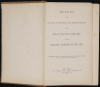
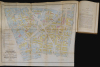
Viele's map and the Report of the Council of Hygiene and Public Health of the Citizens' Association of New York upon the Sanitary Condition of the City had a significant impact on the development of public health in New York City and were a milestone in the emerging field of epidemiological cartography, building on works such as John Snow's 1854 map of the Broad Street cholera outbreak in London. Commissioned by a group of reform-minded physicians in response to soaring urban mortality rates and ineffective local governance, the report was the product of a meticulous, seven-month, street-by-street sanitary inspection of Manhattan. Medical inspectors surveyed thousands of households, carefully documenting the squalid, overcrowded tenements, severe lack of ventilation, and the rampant spread of preventable diseases like typhus, smallpox, and cholera. By translating these horrific living conditions into undeniable empirical and statistical evidence, including precise mapping of disease outbreaks, the report provided the most exhaustive and scientifically rigorous account of urban health ever compiled in the United States up to that time. In addition to Viele's magisterial map, several additional foldout maps, plates, charts, and diagrams drive home the importance of better management of water, sanitation, and other aspects of public health. These include 'Sanitary and Social Chart of the Fourth Ward of the City of New-York' and a foldout map of 'Encroachment of Nuisances [i.e. stables, slaughterhouses, and the like] upon Populous Uptown Districts.'Beyond its unprecedented data collection, the report's true importance lies in its profound legislative and systemic legacy. Although the City had previously established Health Committees (or Commissions) to handle outbreaks of epidemic disease, the present report helped establish the country's first permanent, bureaucratized, professionally-driven municipal health agency. The Report's shocking revelations catalyzed an immense public outcry and successfully bypassed the corrupt political inertia of Tammany Hall, directly compelling the New York State legislature to pass the landmark Metropolitan Health Bill of 1866. This legislation established the Metropolitan Board of Health (forerunner of today's Department of Health and Mental Hygiene), which, among other measures, legally mandated that physicians hold key leadership roles. By proving the undeniable link between poor environmental sanitation and public disease, the 1865 report fueled the movement for strict building codes, organized waste removal, and systematic disease tracking, serving as the definitive blueprint for modern public health infrastructure across the United States.
Publication History and Census
This edition of Viele's 'Topographical Map of the City of New York' was prepared to accompany the Report of the Council of Hygiene and Public Health of the Citizens' Association of New York upon the Sanitary Condition of the City, also offered here (while most other surviving examples are from his manifesto, Topography and Hydrology of the City of New-York). Haskell, in his cartobibliography of Manhattan maps, for some reason identifies this map as being issued in 1864, but no known example exists from that date, nor are there any recorded copyrights on this map from 1864. The first complete editions were issued in 1865. There were, it is noteworthy, several editions issued simultaneously in 1865, all of which might reasonably contend for the title of first. These include a pocket format version and a variant issued for Viele's book on sanitation, both of which were printed on banknote paper. There is also an edition printed on heavier paper for the official presentation. Cartographically all three editions are identical, but all have slightly different titles.The present example is from the edition bearing the pastedown stating that it was 'Prepared for the Council of Hygiene and Public Health.' The map was engraved by Ferdinand Meyer Lithographers of 96 Fulton Street, New York, and the entire report was published by D. Appleton and Co. The present example of the Report also maintains notable provenance, having been sent to the French Consulate in New York (presumably by the publisher), and French annotations (translations) are evident in the map's legend. This edition of the map is increasingly rare on the market in good condition, while the entire Report with the additional foldout maps and plans is even more so. The entire Report is only cataloged at the New York Historical and the Bibliothèque nationale de France.
Cartographers
Egbert Ludovicus Vielé (June 17, 1825 - April 22, 1902) was an American civil engineer, cartographer, businessman, and politician active in New York City during the second half of the 19th century. Born in Saratoga County, Vielé attended the United States Military Academy at West Point. Graduating in 1847, he was commissioned as a brevet second lieutenant in the 2nd United States Infantry. He served in the Mexican-American War before resigning form military duty to pursue a career as a Civil Engineer in New York City. When the call came to plan New York City's Central Park in 1856, Vielé was established as Engineer-in-Chief of the project, and it was he who set down the guidelines by which Vaux and Olmstead ultimately planned the park. He held a similar position as engineer of Prospect Park, Brooklyn from 1860. It was most likely during his tenure with the park commissions that Vielé developed his theories connecting compromised natural drainage with sanitation and infectious disease. Vielé's great cartographic masterpiece, the Topographical Map of the City of New-York, euphemistically known as the 'Vielé Map' or 'Waterways Map' evolved out of the notion that epidemic level disease evolved from excess moisture in the soil. He contended that, as New York City expanded northwards, paving over stream beds and leveling out natural drainage channels, the underground waterways would stagnate and lead to plague or worse. Though intended for the purpose of urban planning, the Vielé Map's (as it came to be known) greatest legacy is as a construction tool. To this day, contractors, architects, and engineers consult the Vielé map to determine if unseen subterranean waterways need to be taken into account when preparing building foundations. He was elected as a Democratic representative to the Forty-ninth Congress (March 4, 1885 – March 3, 1887) and ran unsuccessfully for re-election in 1886. He was heavily involved in New York real-estate interests, but also owned shares of mining and railroad companies as far off as Colorado. Vielé died in April of 1902 and was buried in an elaborate Egyptian Revival tomb at West Point. Legend tells that Vielé, paranoid that he would be buried alive, an unfortunate but surprisingly common problem in the 19th century, installed a buzzer inside his coffin that would allow him to ring the school's commanding officer should the need arise. Apparently, it did not. Further Details...
Ferdinand Mayer (October 19, 1817 - November 14, 1879) was a prosperous lithographer based in New York during the latter part of the 19th century. Mayer was born in Württemberg, Germany, but emigrated to the United States following the 1848 March Revolutions that swept through the German Confederation - maybe as late as 1854. Initially, Mayer was associated with various partners, including Prang, Nagel, and Korff - also German immigrants. By 1855, he established himself at 96 Fulton Street and, within a few years, expanded to the neighboring property at 98 Fulton Street. Meyer produced an enormous corpus of varied work, including music sheets, bank notes, broadsides, maps, and views. His career was probably jumpstarted through an early partnership with the important cartographer Henry Walling, many of whose maps and atlases bear the 'Ferd. Mayer' imprint. His most important publication is most likely Egbert L. Vielé's 1865 Topographical Map of the City of New York, one of the most important and influential maps of New York City ever published. The Mayer imprint appears on documents as, variously, 'Ferd. Meyer', 'F. Mayer', and 'Mayer and Sons'. Further Details...
Daniel Appleton (December 10, 1785 – March 27, 1849) was an American bookseller and publisher who founded one of the most influential publishing houses of 19th-century America. Born in Haverhill, Massachusetts, Appleton began his commercial career in the dry-goods trade, first in his native town and later in Boston, where he also imported merchandise from England. In 1825, he moved to New York City and entered into business with his brother-in-law, Jonathan Leavitt, gradually supplementing his dry-goods inventory with imported English books. Recognizing the greater promise of the book trade, Appleton eventually abandoned dry goods altogether and established a dedicated bookselling and publishing concern at Clinton Hall, near Beekman and Nassau streets. His first publishing venture, William Mason's Crumbs from the Master's Table, appeared in 1831. Appleton's eldest son, William Henry Appleton (1814 – 1899), assumed management of the book department and became a partner in 1838, when the firm adopted the name D. Appleton and Company. Under Daniel Appleton's direction, the house expanded its offerings from importing religious and literary works to include children's books, travel literature, educational publications, and Spanish-language books for the growing Latin American market. Appleton retired in 1848 and died in New York the following year, leaving the business to his sons William Henry, John Adams, George Swett, Daniel Sidney, and Samuel Francis Appleton. Under their leadership, the firm developed into a major international publisher whose catalog embraced literature, history, medicine, science, reference works, travel, and cartography. Its later authors included Charles Darwin, Thomas Henry Huxley, Herbert Spencer, Lewis Carroll, and Arthur Conan Doyle, whose novels, short stories, and essays appeared under the Appleton imprint between 1894 and 1926. The company merged with the Century Company in 1933 to form Appleton-Century, subsequently becoming Appleton-Century-Crofts in 1948; it was acquired by Meredith Publishing Company in 1960. Further Details...
Condition
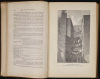
Waterways Map: Very good. Minor verso stabilization at stress points. Wear and toning on old fold lines. Two sheets joined. Minor color disparity between sections. Book: Good. Wear to spine with faded lettering. 503pp. 2 folding maps 1 black and white 1 color. Waterways map removed. 43 illustrations including floor plans for 'healthy homes' and several full page views.
References
Rumsey 3723.000. OCLC 475781255 (entire report). Augustyn, R. T. and Cohen, P. E., Manhattan in Maps, p. 136 - 139. Haskell, Daniel, Manhattan Maps, A Co-operative List, 1132. Stokes, I. N. P., The Iconography of Manhattan Island, 1498-1909, Compiled from Original Sources and Illustrated by Photo-Intaglio Reproductions of Important Maps, Plans, Views and Documents in Public and Private Collections, Vol 3, p.777-778.