1931 International At-A-Glance Chart of North and South America
NorthSouthAmerica-ataglance-1931$350.00

Title
North and South America At-A-Glance.
1931 (dated) 10 x 10 in (25.4 x 25.4 cm) 1 : 103488000
1931 (dated) 10 x 10 in (25.4 x 25.4 cm) 1 : 103488000
Description
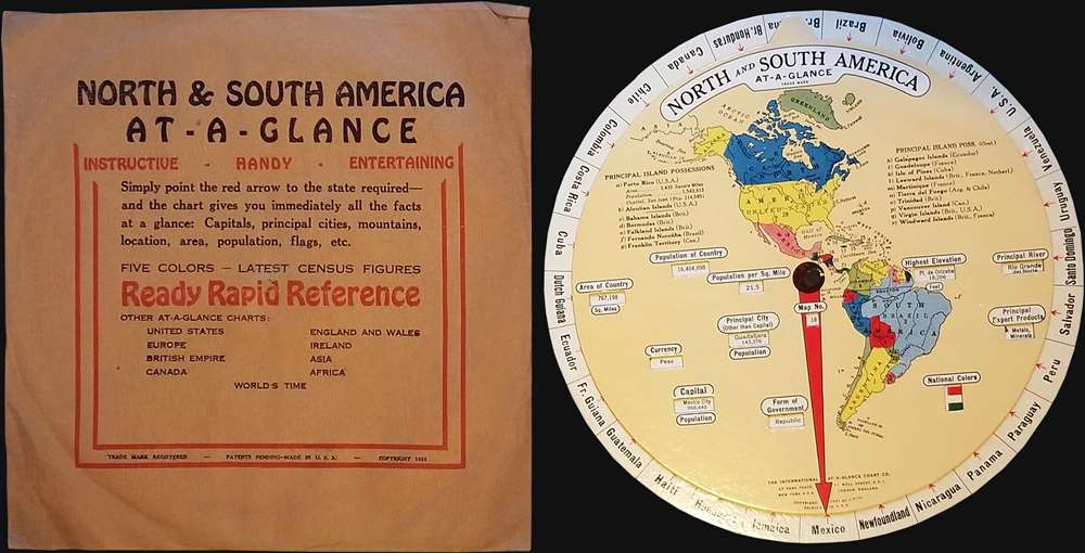
This is a 1931 International At-A-Glance Chart Company map of the Western Hemisphere. Created in the form of an interactive disk, the map depicts the entirety of North, Central, and South America. Meant to be spun, the user rotates the inner disk bearing the illustration of the Americas so that the red arrow points to the desired country. Specific data for each country appears in the windows cut in the central, smaller disk, including the country's capital, form of government, currency, population, highest point, area in square miles, and principal exports. A number also appears near the center, which allows the viewer to locate the selected country on the map if they are not familiar with its location. A list of principal island possessions in the region is present and situated near the top of the inner disk, giving the name of the island and which country possessed it at the time.
This map was created by the International At-A-Glance Chart Company and was published in 1931.
This map was created by the International At-A-Glance Chart Company and was published in 1931.
Condition
Very good. Spins easily. Blank on verso. Accompanied by original envelope. Glare in image caused by light.