
1938 Burwick Pictorial Map of the Pacific Northwest, Northwest Airlines

This item has been sold.
Northwest Airlines Playful Map.
Brief Reign of the Sky Zephyrs.
Choose a Collection:
- Digital Map Information
- Suitable for large format printing
- Full resolution TIFF file
- ICC color profile embedded
- Delivered instantly via download link
This Item
Enquire
Brief Reign of the Sky Zephyrs.
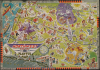
This is a whimsical c. 1938 pictorial map of the Pacific Northwest along with portions of Idaho, Wyoming, and Montana, drawn for Northwest Airlines by an unknown commercial artist identified as 'Burwick'. It reflects the sense of adventure and excitement in the early days of commercial airline travel, which Northwest pioneered in this part of the country.A Closer Look
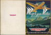
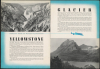
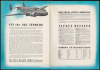
The map, the centerfold of a booklet, covers from Vancouver to the Columbia River and as far east as Billings, Montana, and Yellowstone National Park. A black line traces the route of Northwest Airlines flights and their stops, connecting the 'Gateway to the West' at Billings to the 'Gateway to the Orient' in Seattle. Rich illustrations refer to local history, culture, folklore, and recreation, including cowboys and cowgirls, Native Americans, fishing on the Columbia River, and skiing on Mt. Baker. At the far left and right, references are made to onward connections to California, Hawaii, and Alaska, as well as the Upper Midwest and Chicago in the other direction. At the bottom-left, below the title, is a more compact and comprehensive route map of the Northwest network. Other pages in the booklet trumpet Northwest's connections to Yellowstone and Glacier National Parks, the company's flagship 'Sky Zephyr' airplanes, and information on purchasing tickets.The Early Days of Commercial Air Travel in the Pacific Northwest
Northwest Airlines began in September 1926 as Northwest Airways, a gritty operation focused primarily on flying airmail between Minneapolis-St. Paul and Chicago. As with other airlines in the 'open-cockpit' era, survival depended more on securing government mail contracts than on passenger comfort or safety, leaving few converts to the new mode of transport despite its speed. By the early 1930s, the airline had earned the nickname 'The Northwest Passage' as it aggressively pushed its routes westward toward the Pacific. Following the industry-wide shakeup of the Air Mail Scandal in 1934, the company reorganized as Northwest Airlines, signaling a shift toward becoming a major commercial player.The late 1930s were a period of rapid technical and geographical expansion for the carrier. Northwest distinguished itself by mastering the brutal winter conditions of the northern United States, a necessity for its path through the Rockies to Seattle. With the introduction of modern, twin-engine aircraft like the Lockheed Model 10 Electra and the iconic Douglas DC-3, the airline transitioned from a regional 'stump jumper' into a sophisticated transcontinental contender. Northwest even extended its reach into Canada via Winnipeg, laying the operational foundation for the 'Great Circle' routes to Asia that would eventually define its legacy during and after World War II.
Publication History and Census
This map was drawn by a commercial artist named Burwick, about whom we have been unable to find any additional information. It is undated but was likely issued in the late 1930s, based on the Lockheed Model 14 Super Electra 'Sky Zephyrs'. Northwest bet heavily on the aircraft, entering it into commercial service in 1937 and becoming the airline's main vehicle by 1938. However, a series of three fatal crashes in quick succession raised concerns about reliability, and by the summer of 1939, the Sky Zephyrs were pulled from service and replaced by Douglas DC-3s. Therefore, this map must date to between 1937, when the Sky Zephyrs were put into service, and the summer of 1939, when they were replaced.We have been unable to locate any other examples of this map or the entire brochure in institutional collections or on the market. An academic article cited below refers to an example at the New York Public Library Map Division, but we have been unable to locate it in their catalog.
Condition
Excellent. 13 pages. Staple-bound.
References
Harkins, A. 'Airlines, interstates, and the creation of 'Flyover Country' in the United States,' Transfers: Interdisciplinary Journal of Mobility Studies, Vol. 5, No. 2, 2015.