
1937 WPA Pictorial Map of the Northwest Territory (Ohio, Illinois, Michigan, etc.)


This item has been sold.
The Old Northwest Territory.
'Old Northwest' remembered.
Choose a Collection:
- Digital Map Information
- Suitable for large format printing
- Full resolution TIFF file
- ICC color profile embedded
- Delivered instantly via download link
This Item
Enquire
'Old Northwest' remembered.
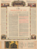
An uncommon 1937 pictorial map of the Old Northwest Territory by Fred Rentschler. The map graphically commemorates the Ordinance of 1787, which created the Northwest Territory and became one of the most influential acts of Congress. The map includes all five Great Lakes and the modern-day states of Minnesota, Wisconsin, Illinois, Indiana, Michigan, and Ohio.A Closer Look
Coverage embraces the territories encompassed by the Northwest Ordinance. It is informatively decorated with vignettes referencing historic events, American Indian peoples, and folklore. The main map is surrounded by historical maps illustrating competing plans for the Northwest Territory, ranging from the 'Thomas Jefferson Conception' to specific state configurations. The verso features a transcript of the Ordinance of 1787, along with additional historical text.The Northwest Territory
The 1787 Northwest Ordinance established the precedent by which the Federal government maintained sovereignty over westward expansion through land grants and the admission of new states, thus superseding the Articles of Confederation and centralizing power in the Federal government. This was a key moment in the development of U.S. nationhood, wherein the idea of being citizens of the United States took precedence over being simply 'Pennsylvanians' or 'Ohioians.'Northwest Territory Sesquicentennial
The 150th anniversary of the Northwest Ordinance of 1787 was celebrated in Ohio in 1937. The celebration was proposed to the United States Congress by the Ohio State Archaeological and Historical Society. President Franklin Delano Roosevelt and the WPA supported the idea, believing that the celebration would help to lift the spirits of a nation mired in unrelenting economic depression. Congress appropriated 100,000 USD for the event. Celebrations included a historical play, an essay contest, lectures, and a wagon train voyage from Ipswich, MA, to Marietta, OH. It was considered a great success.Works Progress Administration (WPA)
The Works Progress Administration (WPA) was an American New Deal agency created on May 6, 1935, through executive order by President Franklin Delano Roosevelt. Part of the Second New Deal, the WPA employed millions of out-of-work Americans on a variety of public works projects, including the construction of public buildings and roads, the decoration of public buildings with art, the sponsorship of cultural events, and more. At its peak, the WPA employed more than three million people. Its most famous effort, Federal Project Number One, employed musicians, artists, writers, actors, and directors in arts, drama, media, and literacy projects. It created several subsidiary organizations, including this map's publisher, the Federal Art Project (FAP). When World War II (1939 - 1945) broke out, the mobilization effort propelled the American economy to full employment. No longer needed, the WPA was officially closed on June 30, 1943.Publication History and Census
This map was drawn by Fred Rentschler for the Federal Art Project, Works Progress Administration (WPA) of Ohio. It was issued by the Northwest Territory Celebration Commission and published in Marietta, Ohio.Cartographer
Fred Rentschler (fl. c. 1920 – c. 1943) was a Swiss-born American artist active in Cleveland, Ohio. Rentschler emigrated to the United States, settling in Cleveland, in the early 1920s. He later taught at the Cleveland School of Art. From 1935 to 1943 he was the head of the lithographic division at the Federal Art Project (WPA) in Cleveland. Rentschler's WPA artwork focused on adult education and challenged the viewer question his ignorances and rectify them. Further Details...
Condition
Very good. Light wear along original fold lines. A few minor margin reinforcements on verso. Text and illustrations on verso.
References
Rumsey 8373.000.