1961 Salomon Map of the New York City Subway System
NYCSubway-salomon-1961$250.00

Title
Official New York Subway Map and Guide, 1961 Edition.
1961 (dated) 20 x 16 in (50.8 x 40.64 cm)
1961 (dated) 20 x 16 in (50.8 x 40.64 cm)
Description
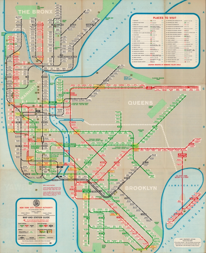
This is George Salomon's 1961 map of the New York City Subway network, an important stepping-stone in the development of today's standard map. Salomon pioneered many features adopted by later subway map designers, including Massimo Vignelli.
Salomon's map was important for eschewing consistent scale (the Bronx especially is 'squished' in relation to its actual size) in the service of functionality. Salomon also was inspired by maps of the London Underground that 'straightened out' subway lines to all be 45 or 90 degrees, which worked especially well with the street grid in New York City. Salomon's map was the first published directly by the NYCTA and was highly influential on later designers of New York City subway maps, including those by Raleigh d'Adamo and Massimo Vignelli, whose subway map is considered a masterpiece of modern design.
A Closer Look
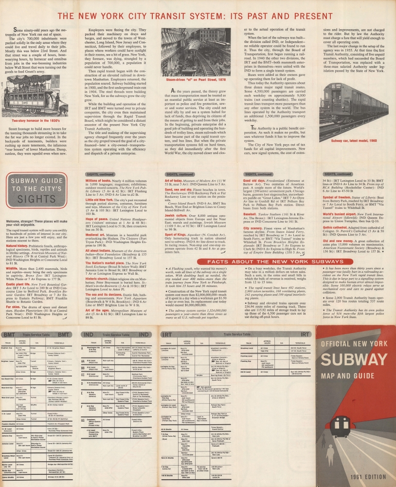
The three systems of the Interborough Rapid Transit Company (IRT), the Brooklyn-Manhattan Transit Corporation (BMT), and the public (city-operated) Independent Subway System (IND) are noted in Manhattan, the Bronx, Queens, and Brooklyn. Although the systems had been merged since 1940, in common parlance they were still referred to as separate. A grid surrounds the map, corresponding to an index at upper-right listing neighborhoods, museums, and other attractions. The verso includes a brief history of the New York City transit system, a guide to reaching famous sites using the subway, fun facts about the subway system, and tables highlighting the various routes of the IRT, BMT, and IND.The Search for a Better Subway Map
The subway system developed through several private companies which were then merged under city management in 1940, evolving into the New York City Transit Authority (NYCTA), established in 1953. However, it seemed nearly impossible to create a map able to effectively display the entire system, with complicating factors like express lines, transfer stations, inconsistent rendering of street and station names, repeated street names in different boroughs (Broadway, for example), extra costs for certain lines, and limited service at certain times on certain lines and at certain stations. In 1957, Salomon sent an unsolicited report to the NYCTA titled 'Out of the Labyrinth' detailing the inefficiencies of the system and possibilities for a new map to capture the entire system in all its complexity. The following year, he produced the first edition of his subway map for the NYCTA.Salomon's map was important for eschewing consistent scale (the Bronx especially is 'squished' in relation to its actual size) in the service of functionality. Salomon also was inspired by maps of the London Underground that 'straightened out' subway lines to all be 45 or 90 degrees, which worked especially well with the street grid in New York City. Salomon's map was the first published directly by the NYCTA and was highly influential on later designers of New York City subway maps, including those by Raleigh d'Adamo and Massimo Vignelli, whose subway map is considered a masterpiece of modern design.
Publication History and Census
This map was produced by George Salomon and published by the NYCTA in 1961. The first edition of Salomon's subway map was published in 1958, and only the first edition is noted among institutional holdings in the OCLC.Cartographer
George Salomon (1920 - 1981) was a graphic designer based in New York who advocated for and helped design a comprehensive and easy-to-use map of the New York City subway system. Born to a Jewish family in Hamburg, Germany, Salomon emigrated with his family to the United States in 1938 after he completed high school. He attended Swarthmore College and established a fund to help fellow refugees from Nazi Germany. After graduating, he moved to New York City to pursue his career in the printing industry and graphic design. More by this mapmaker...
Condition
Very good. Light wear along original fold lines. Text on verso.