This item has been sold, but you can get on the Waitlist to be notified if another example becomes available, or purchase a digital scan.
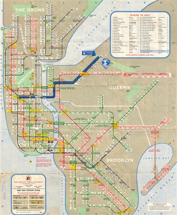
1964 Map of New York City, World's Fair Subway Map
NYSubwayWorldsFair-nycta-1964$50.00

Title
World's Fair Subway Map.
1964 (dated) 19 x 15.5 in (48.26 x 39.37 cm)
1964 (dated) 19 x 15.5 in (48.26 x 39.37 cm)
Description
The 1964 World's Fair pocket map, with the ‘Blue Arrow' motif of the New York Subway was issued by the New York City Transit Authority. The map covers The Bronx, Brooklyn, Queens and Manhattan boroughs and shows the Third Avenue line elevated in the Bronx, the Myrtle Avenue elevated to Jay Street, Brooklyn, the Culver Shuttle, and Nassau Street loop service. The top right corner of the map contains a table of places to visit. The bottom left corner of the map contains a map and station guide. The 1964/1965 New York World Fair was attended by more than 51 million people, making it the third largest world's fair held in New York. The location of the fair was Flushing Meadows Corona Park in the borough of Queens and ran for 2 six month seasons in 1964 and 1965. On verso shows BMT, IND, IRT and the World's Fair Line from 28th street to 84th street along with major tourist attractions and a diagram of the World's Fair grounds. Text on verso includes information about the New York Subway System and the World's Fair Subway Car and highlights of the fair. The map was issued by the New York City Transit Authority.
Condition
Very Good.

