1953 Robuck Pictorial Map of Oahu, Hawaii
Oahu-robuck-1953-2$300.00
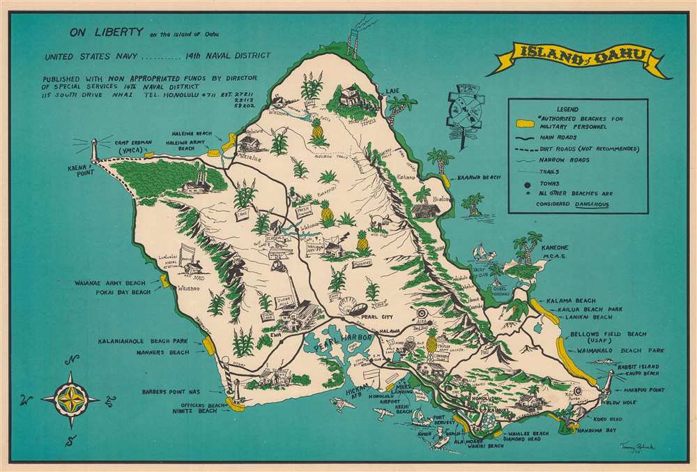

Title
On Liberty on the Island of Oahu.
1953 (dated) 14.5 x 21.5 in (36.83 x 54.61 cm)
1953 (dated) 14.5 x 21.5 in (36.83 x 54.61 cm)
Description
This is a 1953 Tommy Robuck pictorial map of Oahu, Hawaii, issued for U.S. Navy personnel. The Special Services office published this map to help off-duty sailors enjoy the island, while at the same time encouraging dignified comportment. 'Authorized beaches for military personnel' are highlighted in yellow. These include Waikiki Beach, Waialae Beach at Diamond Head, Waimanalo Beach Park, Manners Beach, Waianae Army Beach, and numerous others. Pearl Harbor is prominently illustrated. Pictorial vignettes illustrate other sites around the island, including the Mormon temple, the Lualualei Naval Radio Station, Schofield Army Base, Wheeler Air Force Base, and Hickam Field. Solid black lines mark main roads, while dashed lines mark 'not recommended' dirt roads. Oahu's most plentiful resources, palm trees, pineapples, and sugar cane, appear throughout.
Publication History and Census
This map was drawn by Tommy Robuck and published by the 14th Naval District's Director of Special Services in 1953. Only a handful of other known cataloged examples.Condition
Very good. Light creasing in places.