This item has been sold, but you can get on the Waitlist to be notified if another example becomes available, or purchase a digital scan.
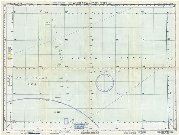
1955 U.S. Air Force Aeronautical Map of Pagan Island, Mariana Islands, Pacific
PaganIsland-usaf-1955$50.00

Title
Pagan Island Mariana Islands.
1955 (dated) 22 x 29 in (55.88 x 73.66 cm) 1 : 1000000
1955 (dated) 22 x 29 in (55.88 x 73.66 cm) 1 : 1000000
Description
This is a scarce 1951 U.S. Air Force aeronautical chart or map of Pagan Island, part of the Mariana Islands in the Pacific Ocean. It covers from Maug Islands to Farallon de Medinilla in northern Mariana Island chain, including the Maug Islands, Asuncion Island, Agrihan Island, Pagan Island, Alamagan Island, Guguan Island, Sarigan Island, Anatahan Island and Farallon de Medinilla. Verso of this chart features legends and a world aeronautical chart index. This chart was published by the USAF Aeronautical Chart and Information Service, Washington 25, D.C., and was issued as chart no. 624. First issued in 1948, this is the third edition revised to Aug 1955.
Condition
Very good. Minor wear and toning along original fold lines. Minor spotting.