1974 Palm Springs Map Guide City Plan or Map of Palm Springs, California
PalmSprings-dumaurier-1974$100.00

Title
Palm Springs Map and Guide.
1974 (dated) 18.5 x 24.375 in (46.99 x 61.9125 cm) 1 : 31680
1974 (dated) 18.5 x 24.375 in (46.99 x 61.9125 cm) 1 : 31680
Description
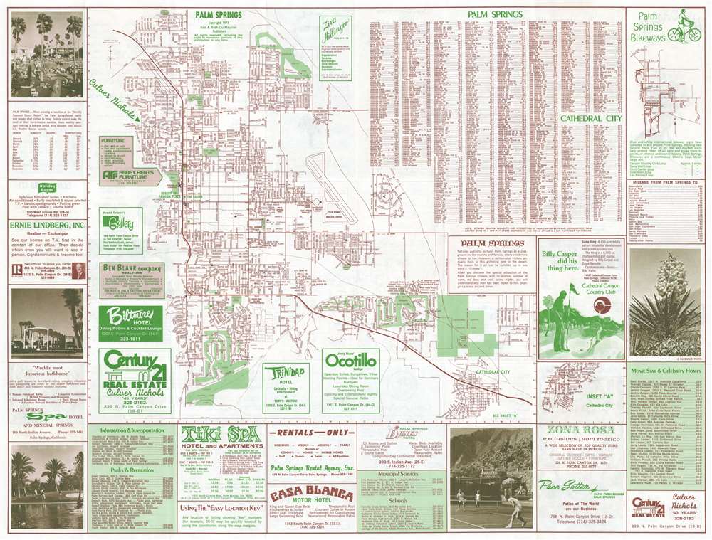
This is a 1974 Palm Springs Map Guide city plan or map of Palm Springs, California. Created for the 'million-plus visitors [that] flock to this glittering gem in the desert', an incredible amount of detail greets the viewer. Streets throughout the city are labeled, along with parks, golf courses, and country clubs (shaded green). Schools, hotels, the Palm Springs Mall, and government buildings are also identified. The Palm Springs Municipal Airport is illustrated and labeled as well. An inset along the right side details Cathedral City. Street indexes for Palm Springs and Cathedral City are situated along the top border near an inset map of Palm Springs Bikeways. Advertisements for local hotels, country clubs, stores, and real estate agents occupy the rest of the sheet.
Verso Content
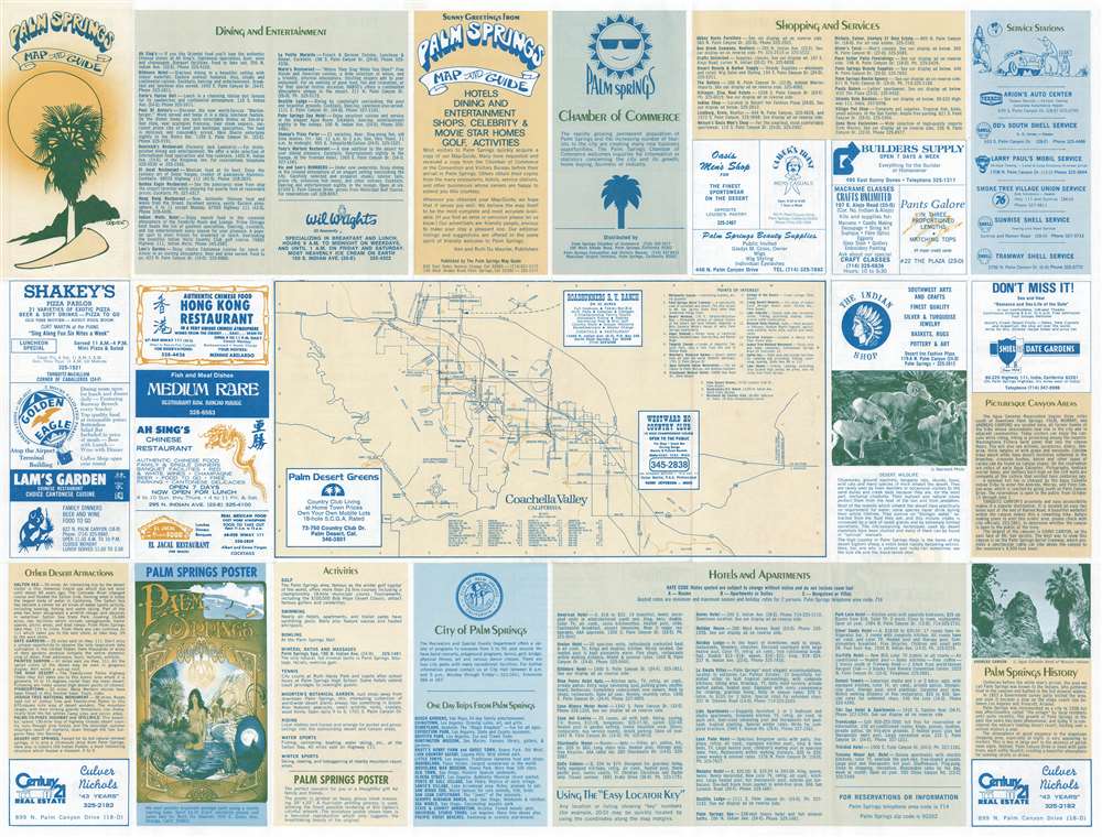
A map of the entire Coachella Valley from Desert Hot Springs south to Salton Sea occupies the center of the verso. More advertisements create a border around the central map, along with indexes providing information about hotels and apartments, dining and entertainment, and shopping and services.Publication History and Census
This map was created and published by Ken and Ruth Du Maurier of The Palm Springs Map Guide in 1974. This piece is not cataloged in OCLC. This is the only known cataloged example of the 1974 edition, however editions of this map were published annually both before and after this edition.Condition
Very good. Exhibits light wear along original fold lines. Closed margin tear professionally repaired on verso. Manuscript ink notations evident on both recto and verso.