This item has been sold, but you can get on the Waitlist to be notified if another example becomes available, or purchase a digital scan.
1900 War Dept. Map of Panay, Philippines, during the Philippine-American War
Panay2-chiefengineer-1900$375.00

Title
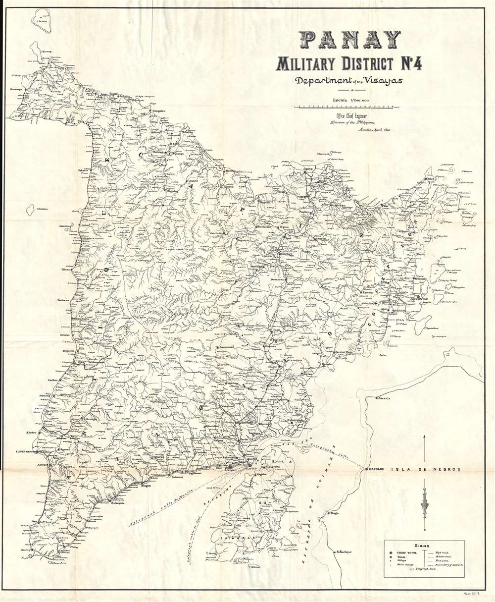
Panay. Military District No. 4. Department of the Visayas.
1900 (dated) 39.5 x 33 in (100.33 x 83.82 cm) 1 : 200000
1900 (dated) 39.5 x 33 in (100.33 x 83.82 cm) 1 : 200000
Description
This is a rare 1900 map of Panay, the Vasayas, the Philippines, issued at the height of the Philippine-American War (1899 – 1902) by the Office of the Chief Engineer in the Philippines. The campaign in the Vasayas began four days after the beginning of the campaign around Manila on Luzon. The campaign began at Iloilo (Ilo-Ilo) on Panay, followed closely by the occupation of Cebu City on Cebu and Bacolod on Negros. Drawn to a scale of 1 : 200000, the map is highly detailed and depicts the entire island of Panay, including the myriad rivers, towns, and villages. The map also labels Negros, although the only town labeled is Bacolod. Telegraph lines crisscross the island, and also connect Iloilo to Manila, Cebu, and Bacolod.
This map was produced by the Office of the Chief Engineer, Division of the Philippines, in Manila in April 1900. We have been able to locate only a couple examples of this map in institutional collections, which would make this example an incredible addition to any collection.
This map was produced by the Office of the Chief Engineer, Division of the Philippines, in Manila in April 1900. We have been able to locate only a couple examples of this map in institutional collections, which would make this example an incredible addition to any collection.
Condition
Very good. Light wear and toning along original fold lines. Verso repairs to fold separations and at fold intersections. Close left margin. Blank on verso.
References
OCLC 380833237.