This item has been sold, but you can get on the Waitlist to be notified if another example becomes available, or purchase a digital scan.
1860 Zimmermann Panorama Map of Switzerland from Rigi Kulm, Swiss Plateau
PanoramaRigiKulm-zimmermann-1860$275.00

Title
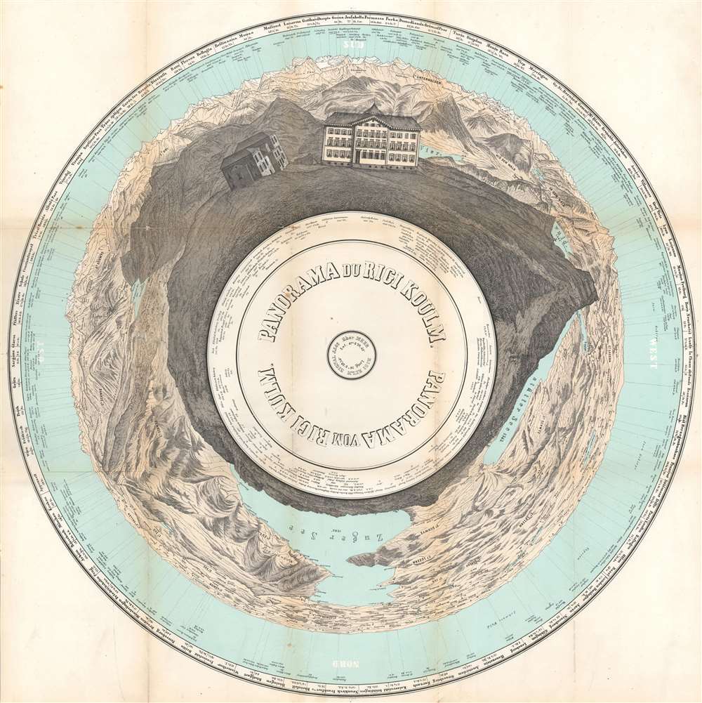
Panorama du Rigi Koulm. Panorama vom Rigi Kulm.
1860 (dated) 21.25 x 21.5 in (53.975 x 54.61 cm)
1860 (dated) 21.25 x 21.5 in (53.975 x 54.61 cm)
Description
This is an 1860 Alphons Zimmermann panorama map of Switzerland as seen from the top of Rigi Kulm, the summit of The Rigi (also known as Mount Rigi and Queen of the Mountains), part of the Swiss Plateau in central Switzerland. Oriented with south at the top of the page, both hotels at Rigi Kulm are illustrated in detail, with the Auberge Schindler just visible above the crest of the summit. Other peaks a full three hundred sixty degrees around the summit are illustrated and labeled, with cities, towns, and cantons also identified, including Lucerne and Schwyz. Rigi Kulm is surrounded on three sides by two lakes the Zugersee and the Vierwaldstättersee. Cities around Europe, from Swiss cities like Lausanne and Bern to cities in France, Germany, the Netherlands, and Poland, are labeled around the outer ring.
Publication History and Census
This panorama was published by Alphons Zimmermann and printed by A. Grimminger in 1860.Cartographer
A. Grimminger (fl. c. 1843 - 1862) was a daguerrotypist and lithographer active in Zurich in the mid-19th century. More by this mapmaker...
Condition
Good. Verso repairs at fold intersections. Closed margin tear professionally repaired on verso. Attached to original binder. Can be removed from binder at additional cost.
References
OCLC 730116732.