This item has been sold, but you can get on the Waitlist to be notified if another example becomes available, or purchase a digital scan.
1899 Bon Marche Map and View of Paris in 1630
Paris1630-bonmarche-1899$125.00

Title
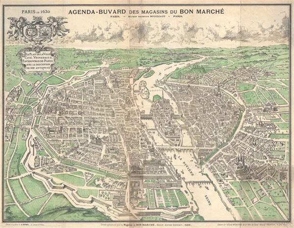
Paris en 1630. / Agenda-Buvard des Magasins du Bon Marche. / Le Plan de la Ville, Cite, Universite, Fauxbourgs de Paris…
1899 (undated) 20 x 26.36 in (50.8 x 66.9544 cm)
1899 (undated) 20 x 26.36 in (50.8 x 66.9544 cm)
Description
An attractive late 19th century illustration of Paris, France as it may have appeared in 1630. Most likely issued around 1899, this map presents 17th century Paris as seen looking West form a position high above the Seine River. Bridges, streets, and important buildings are identified. The surrounding countryside as well as parks and formal gardens are tinted light green. This map was part of a series issued for Honore Champion's Atlas Municipal de la Ville de Paris.. It was drawn by A. Guibal.
Source
Champion, H., Atlas Municipal de al Ville de Paris, c. 1899.
Condition
Good. Some soiling where originally attached to binder. Backed on archival tissue.
References
Vallee, Leon, Catalogue des plans de Paris et des cartes de l'ile de France, 143 (3Ge F 1170).