
1940 Lynde Map of Pasadena, California


This item has been sold.
City of Pasadena California.
City of Roses.
Choose a Collection:
- Digital Map Information
- Suitable for large format printing
- Full resolution TIFF file
- ICC color profile embedded
- Delivered instantly via download link
This Item
Enquire
City of Roses.
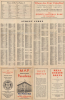
This is John L. Lynde's 1940 map of Pasadena, California, published by Login Printing and Binding for the Security National Bank of Pasadena. It presents the city when it had reached its full florescence, containing many of the buildings and institutions now associated with it, such as the Rose Bowl, Caltech, the distinctive Pasadena City Hall, and the Arroyo Seco Parkway.A Closer Look
Taking in Pasadena, coverage extends to include Altadena and portions of San Marino, South Pasadena, Flintridge (not labeled, now part of La Cañada Flintridge), and the Angeles National Forest in the San Gabriel Mountains (Sierra Madre). Local landmarks, including the Rose Bowl on the left, Caltech (the California Institute of Technology) at center towards the bottom, and the Huntington Library just to the south of Caltech, are prominent. Colorado Street (now Colorado Boulevard, an important part of the historic U.S. Route 66) and Fair Oaks Avenue are outlined in red, and circles emanate from their intersection at half-mile intervals. Local streets are labeled, as are rail lines (of the Pacific Electric, Southern Pacific, and Santa Fe), waterways, hiking trails, canyons, and the remnants of the Mt. Lowe Railway near Rubio Canyon (drawn but not labeled). Schools (marked according to a legend at right), parks, cemeteries, government offices, golf courses, and other public institutions are noted.Two small portions of L. A. County property are cut out of the city at right, north and south of Colorado Street. The northern portion and adjacent areas between Maple and Corson Streets were later demolished to build Interstate 210, the Foothill Freeway, along with a portion of a historic Black neighborhood near the Rose Bowl in northwest Pasadena. The map is surrounded by an alphanumeric grid corresponding to a street index on the verso. The verso also includes a table of distances between Pasadena and other cities in Southern California, as well as advertisements for the Union National Bank of Pasadena.
The Arroyo Seco Parkway
One important feature of this map is the inclusion of the Arroyo Seco Parkway (also known as the Arroyo Seco Freeway), at the bottom-left, which opened the same year as this map's publication. Also known as the Pasadena Freeway, the road was one of the first freeways constructed in the United States, along with the Hollywood Freeway, which opened the same year. It was built along the Arroyo Seco, a mostly dry riverbed that runs from the San Gabriel Mountains past Pasadena and towards Downtown Los Angeles, where it meets the Los Angeles River. Although a road or parkway along this route had been discussed since the late 19th century, and a nine-mile elevated toll cycleway (the California Cycleway) was built in 1900 along much of the route, there was still no easy way to quickly travel between Downtown Los Angeles and Pasadena, even with the widespread adoption of automobiles.There was widespread agreement on the need for a new road by the early 1920s, but opinions differed on the nature of any new road to be constructed. Some urban planners and civic leaders preferred a parkway-like scenic route (see our LATraffic-highwayscommittee-1924), while others, especially the increasingly influential Automobile Club of Southern California, advocated for a speedier route that sacrificed aesthetics for function. The latter camp won out in the end, although the construction of the road still took more than a decade and was beset by all manner of local opposition, which intensified when the true nature of the quiet efforts by the Los Angeles City Engineer to begin surveying the route was discovered. Nevertheless, the necessary approvals were obtained, and construction on the freeway began in March 1938. A short portion was opened later that year, and the whole route opened in 1940. Though it feels a bit meandering and narrow today, compared to 'true' freeways, especially the Interstates that crisscross the greater L.A. Region, the Arroyo Seco Parkway was an important step in the transition from parkways to full-fledged freeways.
Publication History and Census
This map was drawn by John L. Lynde and published by Login Printing and Binding Co. in 1940. It was issued several times between 1940 and 1946. Regardless of printing, this is a rare map. The University of Wisconsin-Milwaukee holds examples dated 1940 and 1946, while a couple of additional examples dated 1941 - 1946 have appeared on the market in recent years.Cartographers
John L. Lynde (fl. c. 1940 - 1975) was a draughtsman and cartographer based in Los Angeles, California. He is best known for his detailed street maps of Pasadena, published by several different companies in the mid-20th century. Further Details...
Login Printing and Binding Co. (fl. c. 1937 - 1973) was a printer and publisher based in Los Angeles. It mostly produced maps, books, and pamphlets related to local history and culture, especially of Pasadena. Further Details...
Condition
Good. Old folds and some splits stabilized on verso.
References
OCLC 913897491, 62726860 (1946 ed.).