
1963 Dolph Map of Lake Worth, Boynton Beach, and Environs, Florida


This item has been sold.
Map of Lake Worth Boynton Beach Florida and Vicinity. / Map of Lake Worth, Boynton Beach and Vicinity Florida.
Florida's Postwar Tranformations.
Florida's Postwar Tranformations.
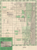
This is a c. 1963 Dolph map of Lake Worth, Palm Beach County, Florida. It is notable for reflecting the area's significant growth as part of a post-World War II demographic, economic, and real estate boom, as well as an early appearance of Interstate-95, still in the planning stages.A Closer Look
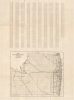
Coverage includes the cities, towns, and villages of Lake Worth (now Lake Worth Beach), Palm Springs, Greenacres, South Palm Beach, Atlantic, Lantana, Hypoluxo, Manalapan, Boynton Beach, Ocean Ridge, and Gulfstream, along with a portion of Palm Beach. Highways and major roads are numbered, while streets are labeled throughout as well as listed in a table on the verso, corresponding to a grid surrounding the map. Parks, golf courses and country clubs, schools, canals, hospitals, nursing homes, police and fire stations, railways, the Palm Beach County Park Airport, and other landmarks are indicated. An image of the First National Bank in Lake Worth, which sponsored the map's publication, appears at left. In addition to the street index, the verso contains a map of the entirety of Palm Beach County with range lines and major roads traced.A legend appears at left as well as a list of schools, which distinctly notes three 'colored' schools in the area (although school segregation had been ruled unconstitutional by this time, the process of implementing desegregation took several years and was only fully executed in the late 1960s). Two of these schools were located in Boynton Beach, a city with a significant African-American population and which, like Lake Worth, counted African American homesteaders among its earliest non-native inhabitants in the late 19th century. The Rangeline School, seen here in Boynton Beach, was known as a 'pocket school,' meant to serve a small community of African-Americans and Puerto Ricans among a larger White community; it was closed in 1965 when the school district was ordered to desegregate.
Preparing for I-95
One interesting feature on this map is the designation of a proposed Interstate-95 route, following the already extant Seaboard Airline Railroad right-of-way. Although the interstate system had been initiated with the Federal-Aid Highway Act of 1956, it took many years of planning, preparation, and construction before the highways were completed as initially conceived. In fact, I-95 was not fully completed until 2018, when a 'flyover' in Bristol Township, Pennsylvania, on the border with New Jersey, allowed a vehicle to travel continuously from the Canadian border in Houlton, Maine, to its southern terminus in Miami, Florida. The opening of I-95 in this section of Palm Beach County facilitated the continued suburban sprawl of this area, well inland of the development seen here, to the Sunshine State Parkway (Florida's Turnpike) and beyond.Publication History and Census
This map was prepared by the Dolph Map Co., based in Fort Lauderdale. It is undated but can be distinguished from other vintage Dolph maps of the same area by the title. The OCLC notes two examples of a map with this title, held by the University of California, Berkeley, and the University of Miami, both of which tentatively date it to c. 1963, which is consistent with the George Brockway city planning maps of Boynton Beach that have been digitized by the Boynton Beach City Library Local History Archives.Cartographer
Frank B. Dolph (October 3, 1897 - November 26, 1975) was an American businessman and map publisher. Born in Great Neck, Long Island, New York, Dolph served as a Navy storekeeper during World War I. He began selling maps in 1919 after returning from England, likely for the George F. Cram Company, where he ultimately became an administrative aide. He also worked for the Rand McNally Company for some time before he founded his own map publishing firm, Dolph and Stewart, with his friend, sometime in the 1920s. Dolph and Stewart made maps throughout the 1920s and 1930s until they sold the firm in 1945 when Dolph decided to return to Florida. Dolph opened a new map publishing business, the Frank B. Dolph Map Co. in Ft. Lauderdale and published city plans of cities throughout the United States. Many of his maps were distributed by Chambers of Commerce or sold at newsstands. Real estate developers greatly appreciated his maps, those published by both the Dolph and Stewart Company and the Frank B. Dolph Company. Dolph retired as president of his firm around 1965, when he handed the business off to his son, Frank B. Dolph, Jr. Dolph worked with cartographer Theodore M. Politano for decades while operating the Frank B. Dolph Map Company. Further Details...
Condition
Very good. Slight toning along old fold lines.
References
OCLC 44970906.