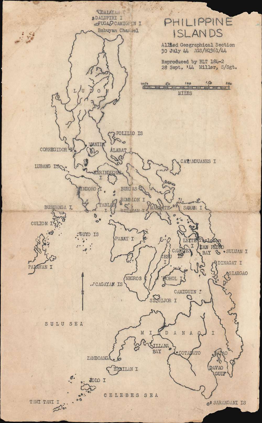
1944 Allied Geographical Section Map of the Philippines
PhilippineIslands-ags-1944$1,500.00

Title
Philippine Islands.
1944 (dated) 12.875 x 8 in (32.7025 x 20.32 cm) 1 : 5100000
1944 (dated) 12.875 x 8 in (32.7025 x 20.32 cm) 1 : 5100000
Description
This is a 1944 Allied Geographical Section mimeograph map of the Philippines. Created for the planning and preparation of the Philippine Campaign, the map is dated twice: once for its publication by the Allied Geographical Section (30 July 44) and a second time when it was reproduced by Battalion Landing Team (BLT) 184-2 (28 Sept. '44), less than a month before the amphibious invasion of the island of Leyte on October 20, 1944. The landings on Leyte marked the beginning of the Philippine Campaign, which lasted until the war ended on September 2, 1945. Each of the islands is labeled, as are a few cities, including Manila on Luzon and Davao on Mindanao, but very little other detail is present.
Battalion Landing Team 184-2 in World War II
Battalion Landing Team (BLT) 184-2 was part of the 7th Infantry Division and fought in the Pacific Theater during World War II. Although the 7th Infantry Division first saw combat in the Aleutian Campaign, the traceable history of BLT 184-2 begins in the Marshall Islands with the January 30, 1944 landing on Kwajalein Atoll. After securing Kwajalein and Eniwetok in the Marshalls, the 7th Infantry Division next saw combat during the amphibious invasion of Leyte Island, the Philippines. BLT 184-2 was held in reserve for the first few days of the Battle of Leyte before being moved up to front line combat and played a critical role during the rest of the battle helping to secure Leyte. After Leyte, the 7th Infantry Division and likely BLT 184-2 took part in the invasion of Okinawa. After the war, the 184th Infantry Regiment, of which BLT 184-2 was a part, was reassigned to the California National Guard.This Map and BLT 184-2
Since this map was originally produced by the Allied Geographical Section, it can be surmised that it was meant to be part of the planning process for the Leyte operation. The present example, which was 'reproduced' by a staff sergeant in BLT 184-2, on September 28, 1944 must have helped in preparing the men of this unit for the assault on Leyte. It is of note that this map is a mimeograph, a short-run printing technique used widely for field reproductions of important document during wartime.Publication History
This map was originally created by the Allied Geographical Section on July 30, 1944 and then was reproduced for use by BLT 184-2 on September 28, 1944. This is the only known example.Cartographer
The Allied Geographical Section (AGS) (1942 - 1945) was formed after a series of directives was issued by General Douglas MacArthur's headquarters that called for the formation of a task force to compile all available geographical intelligence on the largely unmapped and unexplored south-west Pacific area. The AGS produced three different types of publications: Special Reports, Terrain Handbooks, and Terrain Studies. The most complex of these were the Terrain Studies, which were designed to provide the most comprehensive information available. These studies included diagrams, text, photographs, and maps of varying size and detail. All these reports were produced for planning and operational staffs. More by this mapmaker...
Condition
Good. Exhibits some toning and soiling. Closed tear extending one half inch into printed area from bottom margin professionally repaired on verso. Verso repairs to fold separations. Blank on verso.
References
Heinl Jr., Robert D. and John A. Crown, The Marshalls: Increasing the Tempo (Nashville: The Battery Press) 1991. Operation Report 7th Infantry Division King II.