1973 Soviet Department of Geodesy and Cartography Map of the Philippines
Philippines-geodesy-1973$850.00

Title
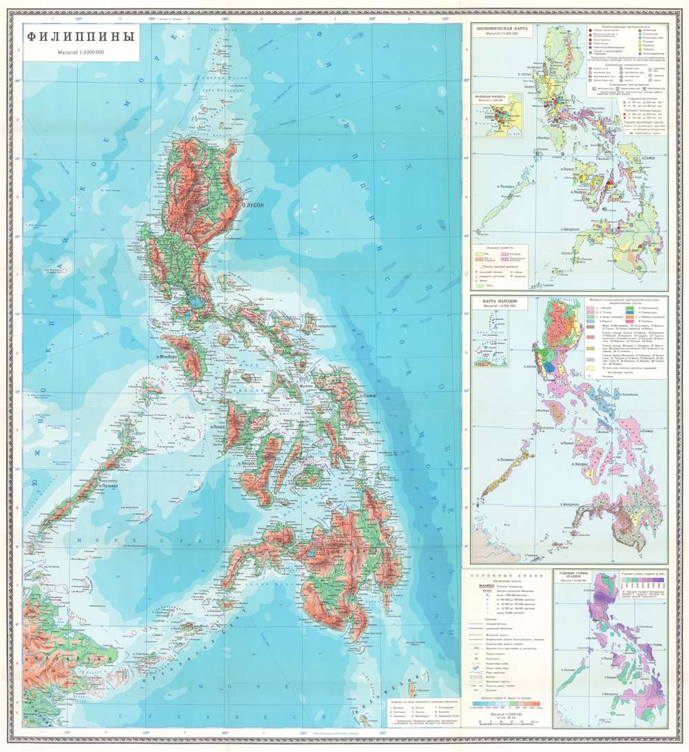
ФИЛИППИНЫ. / Philippines.
1973 (undated) 27.75 x 25.5 in (70.485 x 64.77 cm) 1 : 3000000
1973 (undated) 27.75 x 25.5 in (70.485 x 64.77 cm) 1 : 3000000
Description
This is a 1973 Soviet Department of Geodesy and Cartography map of the Philippines. Depicting the entire archipelago and the surrounding ocean, terrain is illustrated with color-coding. Roads and railroads are illustrated and the purple lines demarcate provinces, each of which is numerically identified and corresponds with a table situated in the lower right corner next to the legend.
The Insets
Three insets occupy the right third of the sheet. The top inset details the archipelago's economy. The various symbols mark aspects of the Philippines' economy, including manufacturing, mining, hydroelectric and thermal power plants, and agricultural industry. An even smaller inset map focuses on Manila's economy and its many industries. The middle inset details the island's many ethnic groups, using color to differentiate between forty ethnicities. The third inset, situated in the bottom right, identifies annual rainfall regionally. According to the map, some areas receive more than four meters of rain a year.Publication History and Census
This map was created and published by the Main Department of Geodesy and Cartography under the Council of Ministers of the USSR in 1973. We have been unable to locate any other surviving examples.Condition
Very good. Exhibits light wear along original fold lines. Accompanied by the original binder.