1945 Japanese Cyanotype WWII Map of the Philippines
Philippines-japanese-1945$950.00

Title
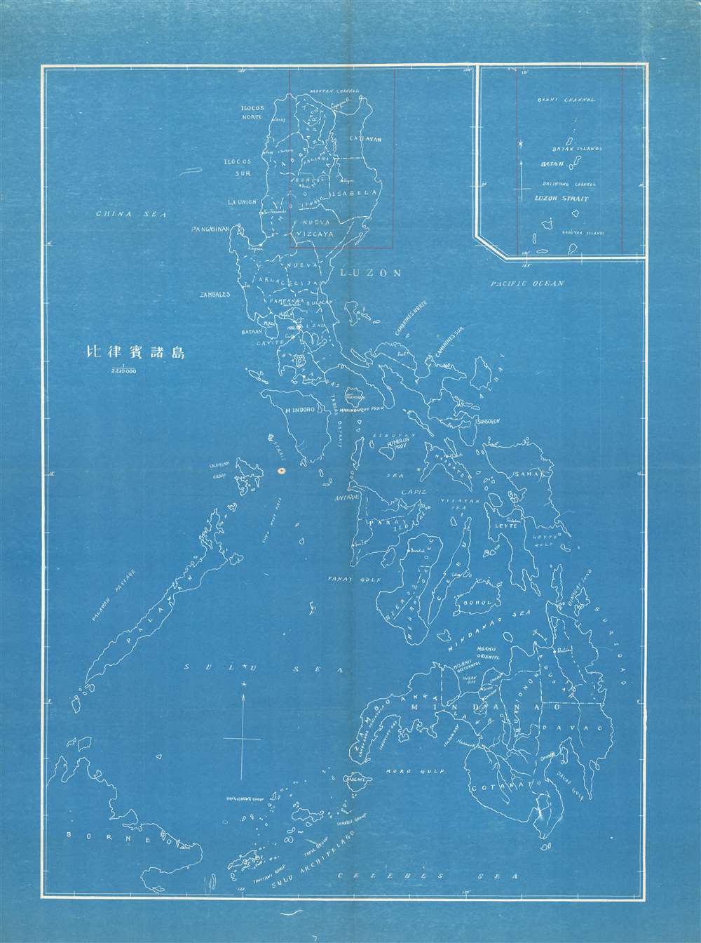
Philippine Islands. / 比律賓諸島
1945 (undated) 28.5 x 21.25 in (72.39 x 53.975 cm) 1 : 2220000
1945 (undated) 28.5 x 21.25 in (72.39 x 53.975 cm) 1 : 2220000
Description
An unusual and unique c. 1945 cyanotype or blueprint map of the Philippines issued by the Japanese, probably during the Philippine Campaign. This is an enigmatic map of which we can deduce little. The map covers all of the Philippine islands. The presence of Japanese text suggests that the map is most likely related to World War II, a fact belied by its crudity. The cyanotype seems to be derived from a crude manuscript copy of a western map - to which a Japanese title has been appended. An inset in the upper right details the Luzon Strait and Bashi Channel (between Taiwan and Luzon), an important region for Japanese forces. Part of Northern Luzon, and an area continuing into the inset, is highlighted in red manuscript and coincidently illustrates the primary zone of Japanese influence in 1944 - 45.
The Philippine Campaign
Launched on October 20 of 1944, the Philippine Campaign was a World War II joint American and Filipino military operation intended to liberate the Philippine Islands from occupying Imperial Japanese forces. The Japanese Army overran most of the Philippines during the first half of 1942, retaining it for the subsequent 2 years. American General Douglas MacArthur began the campaign by announcing on Philippine radio 'This is the Voice of Freedom, General MacArthur speaking. People of the Philippines: I have returned.' The campaign progressed rapidly, driving the Japanese out of one island after another. Although by this time the Japanese were clearly losing the war, they gave no sign of capitulation and refused to surrender. During the course of the campaign Japan suffered nearly half a million casualties compared to only about 50,000 Americans. The campaign continued until Japanese forces in the Philippines were ordered to surrender by Tokyo on August 15, 1945, after the dropping of atomic bombs on Hiroshima and Nagasaki.Cyanotype: Why so Blue?
Cyanotype is a photo-reprographic technique developed in 1842 by the British astronomer John Herschel (1792 - 1871). Sometimes called a 'sunprint', the technique employs a solution of ferric ammonium citrate and potassium ferricyanide, which painted on white paper or cloth, reacts when exposed to sunlight to dye the object a brilliant blue. Areas blocked from ultraviolet exposure remain undyed and white. Herschel developed the technique to reproduce his astronomical notes, but others quickly realized that any object capable of blocking light could be used to quickly and easily create a cyanotype image. By the late 19th century the process became popular with designers, military, architects, and engineers (blueprints), who used the cheap an effective technique to quickly and exactly reproduce images in the field. Cyanotyping is limited in that only a single copy can be made at one time, so it was only practical for short-term field work. It is also of note that cyanotypes remain extremely reactive to light and, over time, fade or degrade, making them extremely ephemeral. The process fell out of fashion in most places by the 1920s, but remains in use in some parts of the world, such as India and Nepal, to this day.Publication History and Census
This map appears to be cyanotype issue of a one-off manuscript copy of a western map - most likely made during World War II. The cyanotype form underscores that very few could have been issued, typically only 2 or 3, and suggests that it may have been a field map of some kind. Probably the only known example.Condition
Very good. Minor wear on original fold lines.