This item has been sold, but you can get on the Waitlist to be notified if another example becomes available, or purchase a digital scan.
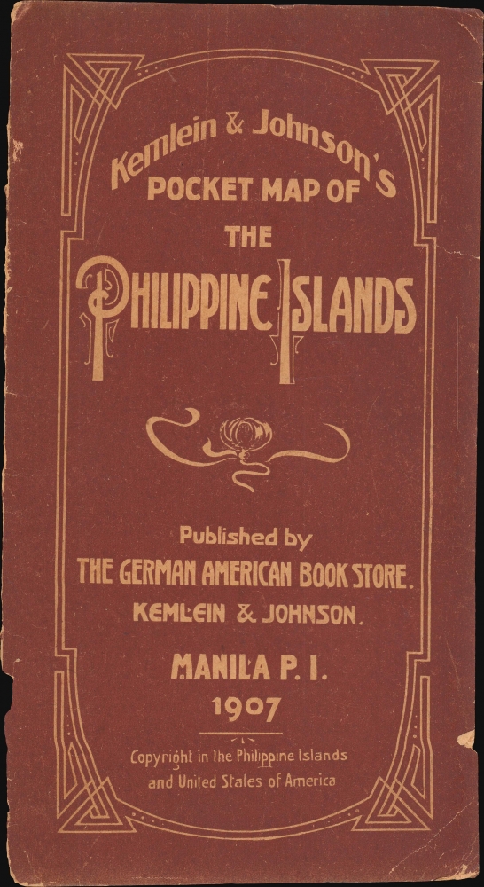
1907 Kemlien and Johnson Pocket Map of the Philippines (Philippine Islands)
Philippines-kemleinjohnson-1907-2$600.00

Title
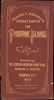
Kemlein and Johnson's Pocket Map of the Philippine Islands.
1907 (dated) 31 x 23 in (78.74 x 58.42 cm) 1 : 2217600
1907 (dated) 31 x 23 in (78.74 x 58.42 cm) 1 : 2217600
Description
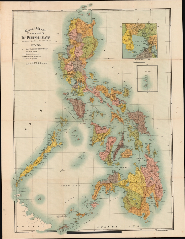
A rare first edition 1907 chromolithograph pocket map of the Philippines issued by the Manila-based German-American publishers Kemlein and Johnson. This is one of the first commercial maps, if not the first, issued in the Philippines following the 1900 American takeover.
This map is rare, with no known holdings of the 1907 first edition, as seen here. A second edition was issued in 1915 and is slightly more common, with holdings at two institutions.
A Closer Look
The map fully covers the Philippine Islands with provinces defined by vivid lithograph color. Extant railways, as well as projected railroads and those under construction, are noted. Topography is dramatically illustrated with shading.Historical Context
As this map went to the presses, the Philippines was transforming under American colonial rule, with infrastructure development at the forefront. 1907 marked the establishment of the Philippine Assembly, a pivotal step towards Filipino legislative governance. This period witnessed the slow transition from military to civilian administration. The economy remained heavily agricultural, with key exports being rice, sugar, coconut, and hemp. Nonetheless, real political power remained mainly in the hands of American officials, with the Philippine Assembly's establishment symbolizing a limited yet significant step towards Filipino self-governance.Chromolithography
Chromolithography, sometimes called oleography, is a color lithographic technique developed in the mid-19th century. The process uses multiple lithographic stones, one for each color, to yield a rich composite effect. Generally, a chromolithograph begins with a black basecoat upon which subsequent colors are layered. Some chromolithographs used 30 or more separate lithographic stones to achieve the desired effect. Chromolithograph color can be blended for even more dramatic results. The process became extremely popular in the late 19th and early 20th centuries when it emerged as the dominant method of color printing. The vivid color chromolithography made it exceptionally effective for advertising and propaganda.Publication History and Census
The map was engraved and printed in chromolithograph by R. Montes Magallanes of Manila. There are copyright entries for the map both in the United States and the Philippines. The U.S. Copyright was filed on August 26, 1907, by George L. Johnson.This map is rare, with no known holdings of the 1907 first edition, as seen here. A second edition was issued in 1915 and is slightly more common, with holdings at two institutions.
Cartographer
Kemlein and Johnson (fl. c. 1906 - c. 1928) were a German-American bookstore and publisher active in Manila during the first half of the 19th century. The firm was founded by George L. Johnson (1879 - November 17, 1945) and H. Kemlein and located at 64-66, Escolta, Manlia.. It is likely that both individuals were American soldiers who remained in the Philippines following the American takeover in 1899. Johnson may have been a prisoner of war during the Japanese occupation of the Philippines during World War II. In addition to selling books in German and English, the bookstore also issued postcards and maps of Manila and the Philippines, as well as a Philippines guidebook. More by this mapmaker...
Condition
Very good. A couple of minor reinforcements along old fold lines, near where partially attached to original binder.
References
OCLC 557004700. British Library: Cartographic Items Maps 89815.(7.)