1955 U.S. Air Force Aeronautical Chart or Map of the Piaui Range, Brazil
PiauiRange-usaf-1955$100.00

Title
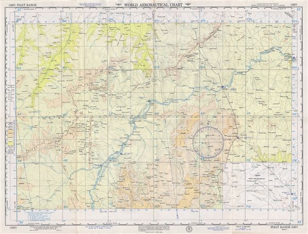
Piaui Range Brazil.
1955 (dated) 22 x 29 in (55.88 x 73.66 cm) 1 : 1000000
1955 (dated) 22 x 29 in (55.88 x 73.66 cm) 1 : 1000000
Description
This is a fine 1955 U.S. Air Force aeronautical chart or map of the Piaui Range, Brazil. It covers parts of the states of Bahia, Piaui and Pernambuco extending from Serrinha north to Jatina and Bodoco and west as far as Cantinho. The Rio Sao Francisco is noted. The map is highly detailed and notes several rivers, towns, lakes, villages and other hydrographical and topographical features essential for the air pilot. Verso of this chart features legends and a World aeronautical chart index. This chart was published by the USAF Aeronautical Chart and Information Center and was issued as chart no. 1067. First issued in 1953, this is the fourth edition revised to July 1955.
Condition
Very good. Minor wear and toning along original fold lines. Minor spotting.