1954 Mayo Pictorial Map of Florida
PictorialFlorida-mayo-1954$150.00

Title
A Pictorial Map of Florida.
1954 (undated) 17.5 x 24 in (44.45 x 60.96 cm) 1 : 1500000
1954 (undated) 17.5 x 24 in (44.45 x 60.96 cm) 1 : 1500000
Description
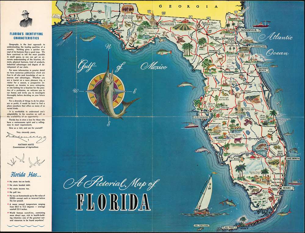
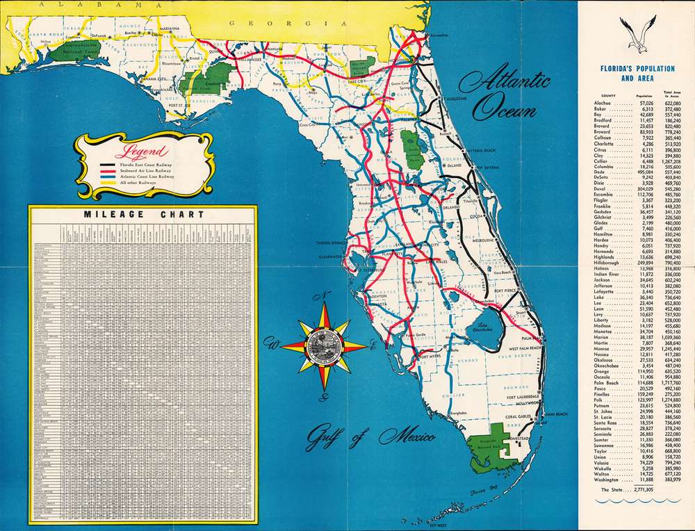
A charming 1954 pictorial map of Florida issued by John Nathan Mayo (1876 - 1960), Florida Commissioner of Agriculture from 1923 to 1960. The map promotes emigration to Florida, advertising the state's 'no tax' policies, warm weather, and sunshine. Maps are printed on both sides. The primary map features rich pictorial content emphasizing Florida's flora, fauna, and agricultural potential. The verso map features highway data, populations tables, and a milage chart.
Publication History and Census
This map was printed for the Florida Department of Agriculture, by commissioner John Nathan Mayo. We note one other example at the Tampa Bay History Center. We note additional examples at Harvard and the University of Michigan. Scarce to the market.Condition
Good. Wear on old fold lines. Printed maps on both sides.
References
Tampa Bay History Center, Touchton Map Library, #2018.055.019. OCLC 855890453.