
This item below is out of stock, but another example (left) is available. To view the available item, click "Details."
Details
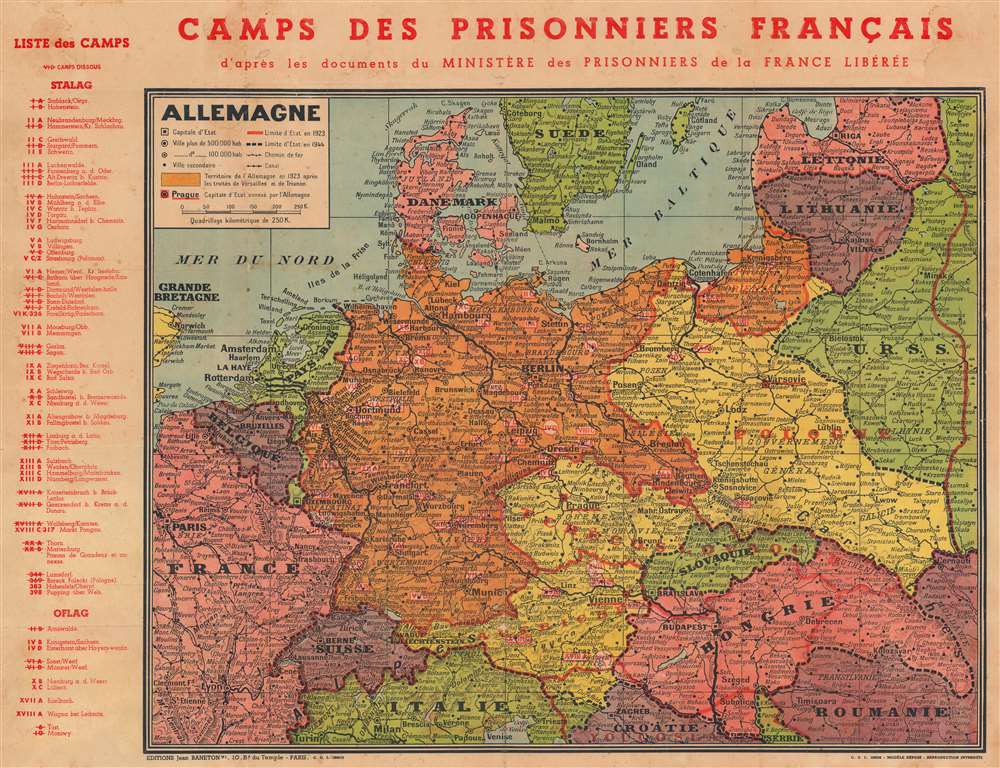
1944 Baneton Map of Europe w/ German Camps for French POWs
$750.00
1944 Baneton Map of Europe w/ German POW Camps for French
PrisonniersFrancais-baneton-1944$375.00

Title
Camps des Prisonniers Français d'après des documents du Ministère des Prisonniers de la France Libérée.
1944 (undated) 18.75 x 24.25 in (47.625 x 61.595 cm) 1 : 3273600
1944 (undated) 18.75 x 24.25 in (47.625 x 61.595 cm) 1 : 3273600
Description
This is a 1944 Jean Baneton map of Europe identifying German camps housing French POWs. Camps throughout Germany, Austria, and Poland are noted, with an index outside the left border separating Stalag (camps for enlisted men) and Oflag (camps for officers). Each camp is identified by its alphanumeric name and its location. The ones that are struck through are camps that were dissolved by the time this map was printed. Conveying impressive historical perspective, red lines mark European borders in 1923, while black dashed lines mark those in 1944.
French Prisoners of War during World War II
It is estimated that 1.8 million French soldiers were captured during the Battle of France (May - June, 1940), accounting for about 10% of the adult male population of France. The prisoners were held in France before being deported to Germany, where they were assigned to Stalag or Oflag. They were forced to supplement the German agricultural and industrial workforce, as most able-bodied German men were then in combat.Publication History and Census
This 1944 map was created and published in Paris by Jean Baneton. We note two cataloged examples. One is at the 'Musée de la Libération de Paris - Musée du Général Leclerc - Musée Jean Moulin' and the other is at the Musée de Bretagne.Condition
Good. Wear along original fold lines. Areas of infill. Soiling.