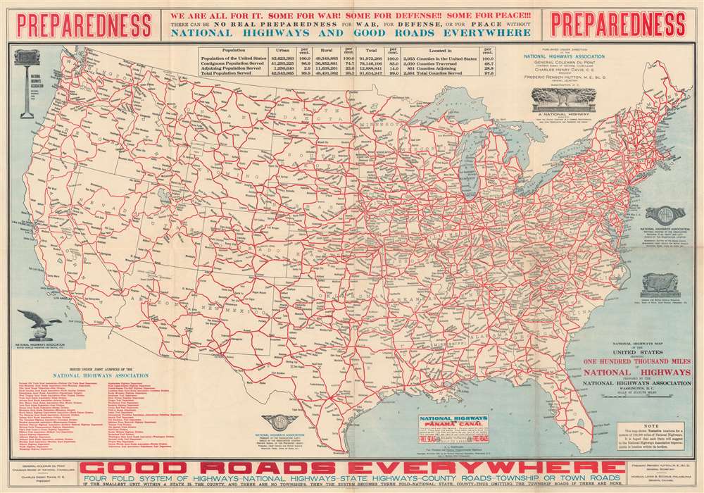
1915 National Highway Association Map of United States Proposed Highway Network
ProposedNationalHwys-ntlhwysassoc-1915$1,600.00

Title
National Highways Map of the United States Showing One Hundred Thousand Miles of National Highways Proposed by the National Highway Association.
1915 (dated) 18.5 x 26.5 in (46.99 x 67.31 cm) 1 : 7250000
1915 (dated) 18.5 x 26.5 in (46.99 x 67.31 cm) 1 : 7250000
Description
This is a 1915 National Highways Association map of the United States depicting its proposed 100,000-mile highway network. It is an early example of the grassroots effort to promote a national highway system. The present example is significant for being issued shortly before the United States entered World War I (1914 - 1918), thus emphasizing the value of such a system to any war effort.
A Closer Look
Bold lines illustrate the national 'spider's web' of highways. National parks, including Yellowstone, Glacier, Mt. Rainier, Yosemite, Sequoia, and the Grand Canyon are identified. Illustrations of National Highways signposts, radiator caps, and other insignia appear in the Atlantic and Pacific Oceans. A table near the top details how the proposed road network would serve 99.8 percent of the population of the United States and 97.6 percent of counties.Preparing for World War I?
A banner above the top border proclaims that 'There can be no real preparedness for War, for Defense, or for Peace without National Highways and Good Roads Everywhere'. 'Preparedness' in bold red lettering occupies both the top left and right corners. As this piece was published in November 1915, the United States would not enter World War I (1914 - 1918) for another 17 months, nonetheless, war was in the air. The National Highways Association accurately advocated the critical significance of a well-maintained national road network to both homeland defense and expeditionary mobilization.The National Highways Association
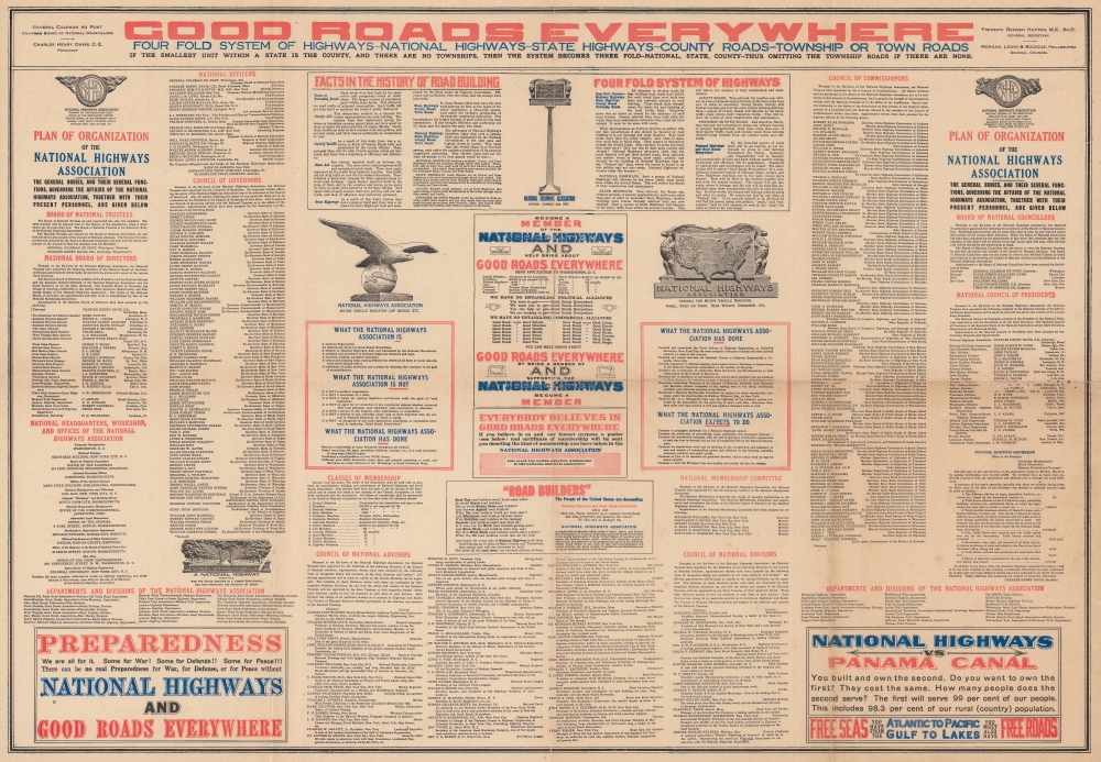
The National Highways Association (NHA) was founded in 1911 by Charles Henry Davis (1865 - 1951) to promote the development of an improved national highway network throughout the United States. One of its most recognized slogans was 'Good Roads Everywhere!' Davis brilliantly affiliated the NHA with highway associations across the country, helping organizations work together to achieve their aims. By 1915, the NHA had proposed a network of 100,000 miles of interconnected highways stretching from coast to coast. The NHA was a prolific producer and publisher of maps, with the association's draftsmen and other employees (which totaled 40 by 1916) operating out of a building on Davis's South Yarmouth property.Highway Associations
The movement promoting the construction of 'good quality' roads did not begin with the invention of the automobile, but rather with the bicycle. At the time, most interurban roads were unpaved and impractical for cycling. The 'Good Roads Movement' was inaugurated in May 1880 to advocate for bicycle enthusiasts, riding clubs, and manufacturers. By 1910, the American Automobile Association (AAA) jumped onboard, along with over one hundred other local and national organizations. 'Road booster' organizations emerged to promote specific, often branded, highways. By the 1920s, about 250 'named' highways, each with their own boosters, crossed the United States. 'Road boosters' still exist, but most disbanded in the 1950s and 60s with the emergence of the federally funded Interstate Highway System.Publication History and Census
This map was created and published by the National Highways Association and published in 1915. We note 14 examples cataloged in OCLC, including: the University of Illinois at Urbana Champaign, the University of Chicago, the University of North Carolina at Chapel Hill, Yale University, and the Boston Athenaeum.Condition
Good. Verso repairs to fold separations. Accompanying sheet in good condition. Wear along original fold lines. Areas of infill along fold lines and at fold intersections.
References
OCLC 13764267.