1845 General Land Office Map of Michigan
PublicSurveysMichigan-landoffice-1845$250.00

Title
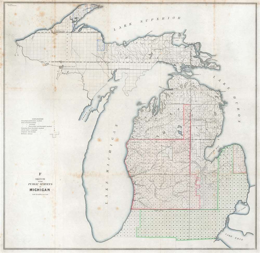
F Sketch of the Public Surveys in Michigan.
1845 (undated) 22 x 22.375 in (55.88 x 56.8325 cm) 1 : 1140480
1845 (undated) 22 x 22.375 in (55.88 x 56.8325 cm) 1 : 1140480
Description
This is an 1845 General Land Office map of Michigan tracking progress of government surveys in the state. The entire state is divided into townships. Symbols are used to inform on the status of the survey work. For example, work in townships near the Ohio and Indiana border is nearly complete, while surveying in the western portion of the Upper Peninsula had not started. A key explaining the various symbols used to identify survey status appears along the left border. While very little detail is provided apart from the township grid, but Michigan's extensive river network is well illustrated.
Publication History and Census
This map was created by the General Land Office and published in a report for the 1st Session of the 29th Congress, which ran from December 1, 1845 until August 10, 1846. We note a single example cataloged in OCLC which is part of the collection at the Bentley Historical Library at the University of Michigan.Cartographer
The General Land Office (GLO) (1812 - 1946) was an independent agency of the United States government responsible for public domain lands in the United States. Created in 1812, it took over functions previously conducted by the Department of the Treasury. The GLO oversaw the surveying, platting, and sale of public lands in the western United States. It also administered the Preemption Act of 1841, which allowed individuals who were already living on federal land to purchase up to 160 acres of land before it was offered for sale to the general public, if they met certain requirements. Following the passage of the Homestead Act in 1862, which was also administered by the GLO, claims under the Preemption Act sharply decreased. The GLO became a part of the newly-created Department of the Interior in 1849. In 1891 Grover Cleveland and Congress created 17 forest reserves, due to public concern over forest conservation, which were initially managed by the GLO, until they were transferred to the Forest Service in 1905. In 1946 the Government Land Office was merged with the United States Grazing Service to become the Bureau of Land Management. Today the Bureau of Land Management administers the roughly 246 million acres of public land remaining under federal ownership. More by this mapmaker...
Condition
Very good. Exhibits foxing.
References
OCLC 35061721.