This item has been sold, but you can get on the Waitlist to be notified if another example becomes available, or purchase a digital scan.
1920 U.S. Engineers Map of Flushing, Northern Queens, Southern Bronx, New York
QueensBronxFlushing-engineers-1920$125.00

Title
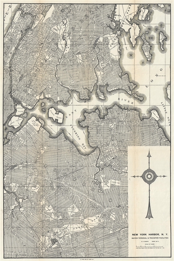
New York Harbor, N.Y. Water Terminal and Transfer Facilities.
1920 (dated) 29 x 19 in (73.66 x 48.26 cm) 1 : 21120
1920 (dated) 29 x 19 in (73.66 x 48.26 cm) 1 : 21120
Description
An uncommon 1920 map detailing the South Bronx and Flushing, in Northern Queens, New York City. Issued by the U.S. Engineer Office, this map focuses on The East River as it flows past Hell Hate and Rikers Island towards Flushing Bay and Long Island. The title suggests that this map is sheet 2 of a larger 4 sheet map intended to illustrate Water Terminal and Transfer Facilities. The focus of the map is unusual and many areas not commonly addressed in antique maps, such as Flushing Queens, Forest Park, Collage Point, Astoria Queens, and the South Bronx are here illustrated in detail.
Condition
Very good. Backed on archival tissue.