This item has been sold, but you can get on the Waitlist to be notified if another example becomes available, or purchase a digital scan.
1954 U.S. Air Force Aeronautical Map of the Red River in Northern Vietnam
RedRiver-usaf-1954$50.00

Title
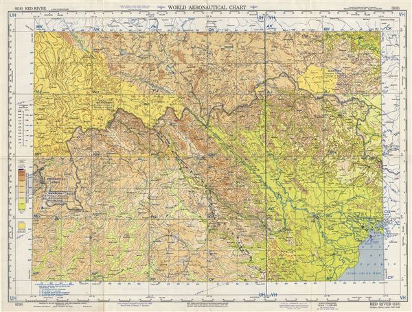
Red River Burma-China-Laos-Vietnam.
1954 (dated) 22 x 29 in (55.88 x 73.66 cm) 1 : 1000000
1954 (dated) 22 x 29 in (55.88 x 73.66 cm) 1 : 1000000
Description
This is a scarce 1954 U.S. Air Force aeronautical chart or map of the Red River or Yuan River in southwest China and northern Vietnam. The map covers from Baise in China south to the Gulf of Tonkin and west as far as the eastern tip of Burma or Myanmar. The cities of Hanoi and Hai Phong are noted. The map is highly detailed and notes prohibited areas, warnings, important cities, towns, rivers, roads as well as other hydrographical and topographical features essential for the air pilot. Verso of this chart features legends and a world aeronautical chart index. This chart was published by the USAF Aeronautical Chart and Information Service, Washington 25, D.C., and was issued as chart no. 616. First issued in 1946, this is the seventh edition revised to May 1954.
Condition
Very good. Minor wear and toning along original fold lines. Minor spotting.