This item has been sold, but you can get on the Waitlist to be notified if another example becomes available.
1972 Khmer National Armed Forces Map of the Khmer Republic (Cambodia)
RepubliqueKhmere-fank-1972$300.00

Title
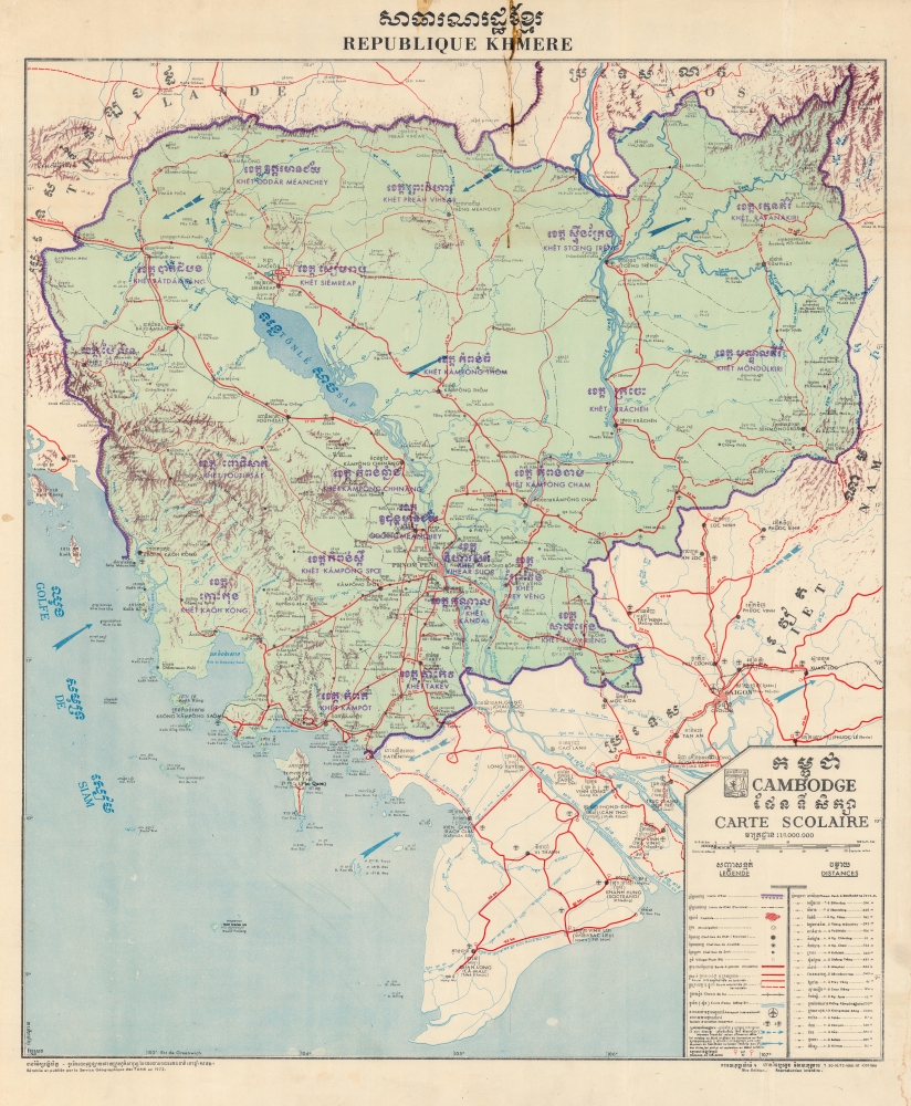
សាធារណរដ្ឋខ្មែរ. Republique Khmere. Cambodge Carte Scolaire.
1972 (dated) 29.5 x 24 in (74.93 x 60.96 cm) 1 : 1000000
1972 (dated) 29.5 x 24 in (74.93 x 60.96 cm) 1 : 1000000
Description
This is a 1972 bilingual Khmer and French Forces armées nationales khmères (FANK) map of Cambodia under the Khmer Republic. The map captures the short-lived period between the overthrow of the Cambodian monarchy and the rise of the Khmer Rouge.
A Closer Look
Cities, towns, villages, and rivers are labeled in Khmer and French, while purple overprinting in both languages identifies provinces. Red highlights highways and airplane icons mark airfields, including the international airport in Phnom Penh. Blue arrows illustrate the prevailing monsoon winds. A portion of South Vietnam appears in the lower right, and, although not given the same level of detail, cities and towns are identified.The Forces armées nationales khmères
The Forces armé nationales khmères (FANK) (Khmer National Armed Forces) were the Khmer Republic's official defense forces. They were the successor to the Forces armées royales khmères (FARK), the armed forces of the Kingdom of Cambodia since its 1953 independence from France.The Khmer Republic
The Khmer Republic came into being following a coup d'état on March 18, 1970, when Lon Nol (1913 - 1985) overthrew King Norodom Sihanouk (1922 - 2012). Lon Nol's coup was almost legal, occurring through legislative action in the National Assembly, which voted unanimously to withdraw confidence from the Sihanouk Monarchy. Lon Nol took emergency powers, becoming the head of state. His regime, backed by the United States (although no proof exists that the U.S. helped or participated in the coup), devolved into a military dictatorship. The FANK proved incapable of defeating the new republic's enemies, and it fell to the Khmer Rouge on April 17, 1975.Publication History and Census
This map was created and published in 1972 by the Forces armées nationales khmères (FANK). We note a single cataloged example, located at Cornell University. FANK published a map bearing the same title in 1971 which appears in two institutional collections: the Library of Congress and the University of Wisconsin-Madison.Condition
Good. Soiling to title. Closed margin tears professionally repaired on verso.
References
OCLC 64013599.