1925 Suder Panoramic Map of Middle Rhine, Germany
Rhine-suder-1925$200.00

Title
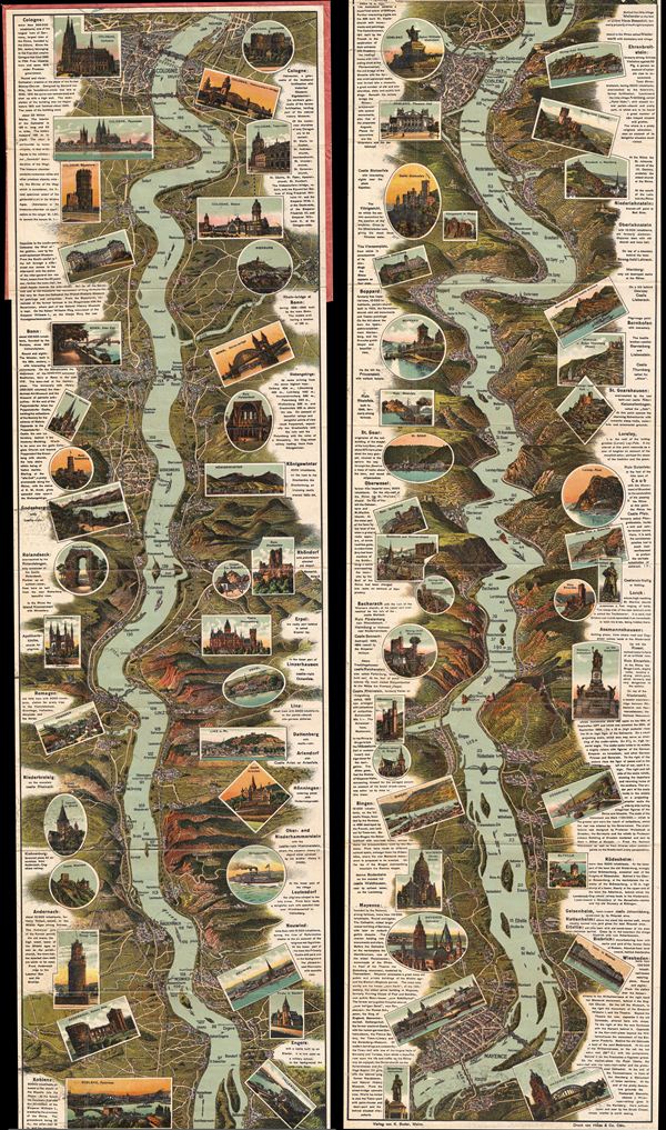
Guide-Panorama of the Rhine from Mayence to Cologne.
1925 (undated) 66 x 9.5 in (167.64 x 24.13 cm)
1925 (undated) 66 x 9.5 in (167.64 x 24.13 cm)
Description
This is a beautiful example of the Suder - Heiss 1925 panoramic view or map of the River Rhine. This region, today a UNSeCO World Heritage Site known as 'The Romantic Rhine' is one of the most scenic parts of the river, featuring the dramatic Rhone Gorge as well as more than 40 castles and fortresses, vineyards, and quaint country towns. This chromolithograph view follows the Rhine (Rhin) from Cologne to Mayence (Mainz), featuring numerous landmarks and places of interest along the way. Ships are seen sailing along the river, while important landmarks, towns, and even buildings are rendered in profile. To either side of view proper, short descriptions of the most interesting villages and towns along the banks are included. Though undated, the information included in these descriptions regarding the population and other statistics point to the early 20th century, shortly after World War I. The whole folds into its original paper binder. This view was published by K. Suder and Heiss & Company of Cologne.
Condition
Very good. Original fold lines visible and exhibit some wear. Blank on verso. Folds into original binder.