This item has been sold, but you can get on the Waitlist to be notified if another example becomes available, or purchase a digital scan.
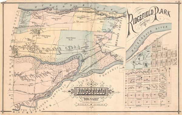
1876 Walker Map of Ridgefield, New Jersey
Ridgefield-walker-1876$87.50

Title
Ridgefield, Township.
1876 (undated) 16.75 x 27.25 in (42.545 x 69.215 cm)
1876 (undated) 16.75 x 27.25 in (42.545 x 69.215 cm)
Description
Exquisitely detailed 1876 map of Ridgefield Township, New Jersey, showing roads and property owners' names. With an inset of Ridgefield Park, showing numbered lots. Notable is the early depiction of school district boundaries in a state that today publicizes the high quality of its schools in the context of property values. Published as plates 152-153 in Walker & Pease' exquisite 'topographical, illustrated, historical, descriptive' Atlas of Bergen County, New Jersey, 1876. On verso appear similar maps of Leonia, Fort Lee and Taylorville, with an inset of Edgecliffe. Palisade relief on these last two is shown by hachure.
Source
Walker, A. H., and Pease, C. C. Atlas of Bergen County, New Jersey, 1876.
Condition
Good. Even overall toning. Original centerfold exhibits some wear and in verso reinforcement. Minor discolorations here and there. Edge wear mostly confined to margins.
References
Phillips (Atlases) #2152.